Monday, January 30, 2012

SPRING-LIKE TEMPERATURES!

Good afternoon everyone! We have started the work-week on a fantastic note, as temps are soaring into the middle 50's in Indy today, under lots of sunshine. It is just perfect outside today. A warm front has been lifting through the state. You can see the temperature difference, from 39 in Fort Wayne, to near 60 in southern Indiana:


By tomorrow, it gets even warmer! Is this really winter? Many areas will hit or top the 60 degree mark tomorrow! Winds will become gusty, and the clouds will increase ahead of a cold front. Tomorrow will be a spectacular day to head out to the Super Bowl activities!

On Tuesday night, we will track a cold front, which will bring showers to the region:


The good news is that much of the rain will move out Wednesday, with some clearing by Wednesday afternoon, as the warm air hangs on. Highs should hit the low-mid 50's Wednesday.

The rest of the week will be dry and cooler for Thursday and Friday, with highs in the middle/upper 40's. The weekend forecast is still WAY up in the air, as the models have made dramatic changes!...

The gfs and euro are now in agreement that a low will track northwest of Indiana, meaning warmth and storm chances this weekend. That is quite a change from yesterday's runs! That is exactly why I say to never get exctied over a potential storm 7 days out! But..... THIS IS NOT SET-IN-STONE YET. There is still great potential that the models will make more wild changes tomorrow! It will be at least Wednesday until I can get a better idea of what may happen. The cold air is coming, but it may hold off until next week. What I can tell you that the trends are not good for snow-lovers! :( Snow dance anyone? :)

Have a great rest of your day, and enjoy the mild temperatures!

SUPER BOWL FORECAST - SUPER WEATHER!


Many people may mistake Indy for a southern city this week, as our temps will soar near 52 degrees today,   under partly sunny skies! If that isn't enough, lots of sunshine is in your Tuesday forecast, and I'm going for a high temperature of 61 degrees tomorrow, under a strong southwest wind! Enjoy! Rain chance returns late Tuesday evening and night, but will move out Wednesday morning. Highs Wednesday will remain in the 50's. Slighty cooler, but still above average Thursday and Friday, with mainly dry conditions. Not a bad forecast! :)

Sunday, January 29, 2012

WINTER STORM NEXT WEEKEND?

Good Sunday evening! Well if your a snow-lover, this post will make you smile!! :) I am happy to say the models are getting a better agreement on a major snow storm for Super Bowl weekend! Here is the potential set-up:


Anybody in the Ohio Valley is in the game at this point. That is a perfect track to get heavy snows around here, and yeah, the kind where you can get significant totals! I've said all along that the cold and these big storms have to link up at some point, and it just may happen Super Bowl weekend. Now let's get to the models to prove my thoughts. The latest EURO is in full agreement on a big storm, with the cold air right over the Ohio Valley:


MY THOUGHTS: It is still VERY early in the game, about a week away. Lots can change, so don't get too excited just yet! I do like that more models are jumping to this solution, and also, the indices are lining up just right to get a storm track to our south, bringing snow to the area. Don't forget how much things can change, so don't be surprised many changes to the forecast this week. I will call this storm promising. The problem is, that this storm looks to hit during the heart of the Super Bowl weekend, likely Super Bowl Sunday itself. STAY TUNED.

Have a great evening, and think snow!! :)

STRETCH OF 50'S ON THE WAY - BIG CHANGES NEXT WEEKEND?

Good afternoon everyone! We are wrapping up the month of January, with a huge disappointment for snow lovers, including me! Indy has only received near 6" for the entire season so far, and only about 6-7 weeks until spring! Ole' man winter needs to wake up and get moving! The good news is that the mild pattern can't last forever, and a lot of signals are showing me that winter is going to really try to get going from February into March. :) More on that in just a moment.

First off, the winds! Today is going to be a very windy day! While southern Indiana is basking in sunny skies, I am watching areas north of I70 today, where snow showers are likely. If you live in the Muncie/Anderson area, a heavy snow squall is heading in your direction, and will make travel tough for a while. I zoomed in on radar, and you can see the snow from Noblesville to Muncie right now:


Keep that in mind if you are heading anywhere from Indy and points north.

Now we move on to next week. VERY warm temps will surge in the area from tomorrow-Thursday. Highs tomorrow will be near 50 as a warm front moves in. Tomorrow will be a great day for those headed out the the Super Bowl activities. Then perhaps upper 50's on Tuesday ahead of a cold front. With that said, that will create very gusty southwest winds on Tuesday, with rain chances increasing towards evening:

Day 3 Fronts and Pressures


The good news is that any rain will move out by mid-day Wednesday, meaning much of the week will be warm and mainly dry for Super Bowl activities. It is beyond Thursday where the models are ALL OVER THE PLACE.

Instead of getting into the details, I will wait until the models show any trends. Here are what some models are showing right now:

EURO: Is showing possible accumulating snow Thursday into Friday, then an arctic blast of cold for the weekend.

GFS: It was on board for cold and snow next weekend, but keeps changing with every run. It now shows no snow at all, and says any cold will be quick, and warmer by Sunday. I'm NOT buying the GFS right now! It is completely out of wack! lol!!

Bottom Line: I think we will see a pretty big cold shot for the weekend, as the NAO dips into the negative catagory. I think the pattern is ripe for a winter storm during this time, but certainly just too far out to get into the details. If I were to go with the EURO right now, highs in the upper teens would be likely for Super Bowl Sunday, along with snow on the ground. Check out how far south the euro puts the cold air a week from today:


Now if you want to look farther down the road into February, the indices are lining up better for a wintry pattern around here:


Notice how the NAO dips into negative next weekend, then shifts slightly positive by mid-month. I still think February will be a better month for snow-lovers, but let's wait and see.

Have a great afternoon!

Saturday, January 28, 2012

7-Day Outlook

Good evening! I just updated the 7-Day Forecast! In quick summary, it looks like a few flurries are possible in northern Indiana tomorrow, otherwise windy and mostly cloudy. Big-time warm-up Monday-Wednesday (50's) with small rain chances, mainly late Tuesday into early Wednesday. Certainly lots of dry weather can be expected  for those heading to Super Bowl activities. Cool-down late week into the weekend, SNOW is looking possible by next Saturday!.....

3 YEARS AGO TODAY....

3 years ago today, a MAJOR snow and ice storm struck the Ohio Valley, from January 26th-28th. This storm left millions in dark in Kentucky, and much of central and southern Indiana was measuring snow in FEET!

In Indianapolis, 12.5" of snow fell from the 26-28th, making it the 6th largest snowstorm to ever hit Indianapolis. Here are several pics from the NWS:


Ice Totals: Much of southern Indiana picked up over a 1/2" of icing, to go along with 8-12" of snow! That made for a extremely dangerous situation! To the south of Indiana, as much as 2" of ice accumulated in Kentucky!! This left several thousands in the dark for DAYS, and the state was declared a state of emergency. Check out some of these pictures from that ice storm, incredible!...


Truly an amazing winter storm! I remember having snow drifts up to 3 feet deep in my front yard! The highest snow total from the storm was in Paragon, IN where 16.3" of snow was reported.

What are your memories from the major winter storm three years ago? Feel free to post in the comment section. More updates later today. Have a great afternoon!

Friday, January 27, 2012

Where Has Winter Been???

I know, I know, this winter has been BORING for snow-lovers, including me. Despite that, it sure isn't lacking in the interesting department! I will get on to our snow chances in a minute, but first, let's talk about where we been, and where the pattern is going.

We simply have not seen any good snows yet, because the pattern has been WAY too fast moving. Even the few small snows we have picked up, they have been very quick moving, which is why we haven't had a good snow yet. This has been a winter with a zonal flow, meaning weak and FAST moving systems have been moving through the region, along with the cold air only being able to stick around for short periods. The cold air IS up there, in fact, it has been extremely cold to the north. The problem is that we have only been able to maintain a north wind for 24-36 hours, before switching directions back to the south. We have seen this take place over and over again this winter.


Another issue, are the jet streams. Something we call the northern and southern jet stream. The northern bracnch has stayed WAY north of us, keeping the cold air "locked up". So, even when systems have taken a "good track for snow here", the cold air has been lacking so much that it has caused all the huge systems to produce rain here. Just think for a second. What if all those big storms would of been snow. That would be a LOT of snow. Here is a better look at how the polar jet and the southern jet have remained seperate:


Here is the pattern we NEED to get a cold/snowy pattern around here:

33greenlandblock

We need that dip in the jet stream to help slow-down and deepen low pressure systems. So far, the Greenland Block has been absent.

Now if we want to get any idea what lies ahead of us, let's take a look at the NAO charts. To get a long-term trough, or big snows, we want the NAO to go negative. Let's take a look:

NAO: mainly neutral, slightly positive:

33nao

PNA: positive.

33pna

Ok, I know your probably getting bored of this geeky talk. :) Here are my thoughts for February:

I think the pattern will remain pretty similar, just a bit more amplified cold shots, and a few decent snow-makers. I think the pattern will give us some surprises, and I think temperature-wise will still be slightly above average, but there will be some more cold shots than January.

I have heard WAY too many weather blogs bashing that winter is cancelled. Don't you know it can snow into April around here? With all the big storms that have produced rain, if we get some cold air and the storms to link up, we will quickly add to our season total. I am NOT giving up at all! Just think, IF that system yesterday were to be an all snow event, we would be measuring in FEET!

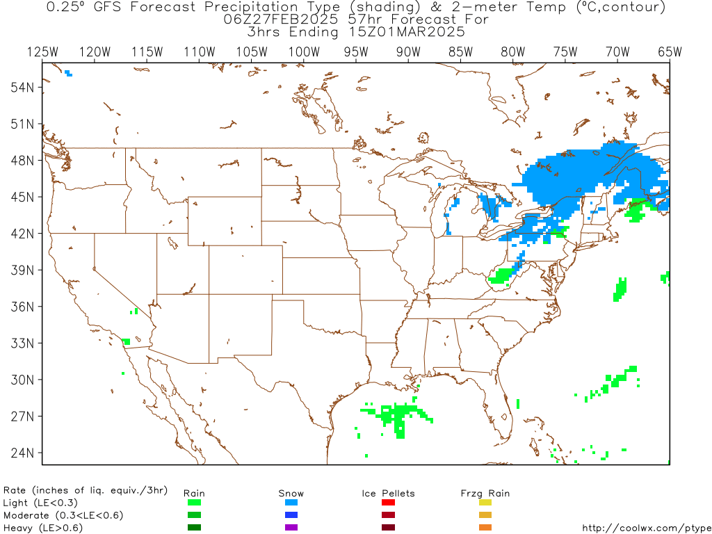
Alright, let's get on to the present. A mix is still looking likely tonight, changing to all snow late tonight. Up to 1" of slushy snow is possible in Indy. Less south, more north. Here is the snow potential map from midnight-7am Saturday:


Not a big deal, but there may be slushy roads along and north of I70 tomorrow morning. The good news is that temps will stay near freezing through the event.

The next system arrives early Sunday. Flurries or snow showers will be likely, mainly north of Indy.


Beyond that, 50's are likely Tuesday-Thursday!! A few rain chances are possible during this time, but the warm temperatures will be great! It is beyond Thursday where things get interesting! Snow is possible next Friday or Saturday, then a potential arctic air mass moving in for Super Bowl Sunday. I will keep you updated on this over the next several days.

Thanks for checking out the blog. Sorry for the long update! Have a great rest of your day.

Tracking Snow Chances

Good morning! After that soggy Thursday, we actually have a chance of seeing sunshine later today! Enjoy it, because snow is in the forecast tonight!

A system will move in just before midnight, spreading a mix of rain and snow into the state. Most locations will change over to all snow after midnight, with a mix in southern Indiana.


Snowfall potential looks to be a coating to an inch in Indy metro, a dusting south, and possibly over an inch in northern Indiana.


So not a major system, but could be enough to create slushy roads tomorrow morning. The next system arrives early Sunday. This will bring a round of flurries or snow showers to the area.


Some areas could pick up a dusting early Sunday, but certainly not a big deal. I know snow-lovers, including me, are just waiting and waiting for the first real snow! Some models are showing to potential for a nice snow-maker late next week, or early next weekend. Stay tuned!

Have a great day!

Thursday, January 26, 2012

Snow Chances??

Good afternoon! The weather out there today - blah! Scattered showers, and temps around 40. If you want warm temps, head just south of the Ohio River, where temps are in the 60's! I wanted to update you on possible snow chances on the way this weekend.

A cold front will be moving in late Friday night and early Saturday. This will spark snow showers, especially along and north of I70. Southern parts of Indiana may see a mix.


This little system may be enough to create a coating of snow in Indy by Saturday morning, with an inch or so in northern Indiana, as energy moves throught the area.


Our second, and smaller snow chance comes our way early Sunday. This looks to be just some quick-hitting flurries and light snow showers for Sunday morning. Not a big deal.


So, at least there's a shot of seeing snow in the air at different points this weekend! To follow my weather page on facebook, click the link here:

http://www.facebook.com/#!/Nathanlovesweather4

Have a great rest of your day!

Wednesday, January 25, 2012

Evening Weather Update

Good evening! After a burst of snow/sleet this evening, which dropped up to 1" of snow northwest of Indy, is starting to turn over to rain as the temperature is up to 34 degrees. The picture on the right was taken in Lafayette this afternoon.

Evening/Overnight Forecast: ONE degree CAN make a difference! For Indy and points south, it will fall as rain, mixed with sleet or freezing rain at times. Roads in Indy should remain pretty clear, just wet. I wouldn't rule out light icing on powerlines, trees, but certainly no major travel problems. As one heads NORTH of Indy however, yeah, this is where the problems are likely. Freezing rain/sleet/and snow will fall in north-central Indiana, making roads and sidewalks slick tonight! Keep that in mind if you live or are heading north of Indy overnight. Areas south of I70 will remain all rain it appears. Here is my snow/ice map:


I can't stress enough that this is a tricky forecast, where one degree can make a difference! Have a great night everyone!

Rain Update

Rain should arrive in Indy metro by 3pm. The precipitation may start out as freezing rain, but should turn to all rain later in the evening. If you are traveling north, freezing rain will be possible through the night. Temperatures will remain in the 32-36 degree range through the evening. Don't forget about the radars tab at the top of the page, to track the rain's arrival! Have a great rest of your day!


Don't forget to "like" my weather page on facebook! Here's the link:  http://www.facebook.com/#!/Nathanlovesweather4

FREEZING RAIN POSSIBLE FOR SOME!

Good afternoon! As our temperatures continue to hover around freezing, and the precipitation gets closer, I am concerned that we will be dealing with freezing rain this evening. Here is my latest ice map for this evening:


I think many roads will stay wet, but the trees/cars/elevated surfaces may get a thin coating of ice this evening, especially from 3-7pm. The good news is that it should quickly turn to all rain after 7pm in central Indiana. Areas to the north may be dealing with icing overnight, making driving very slick and hazardous. If you are in southern Indiana, it will stay all rain. Here is the statement from the NWS:

...FREEZING RAIN OR SLEET POSSIBLE THIS AFTERNOON...

SLEET AND FREEZING RAIN ARE POSSIBLE OVER CENTRAL INDIANA THIS
AFTERNOON. ANY ICE ACCUMULATIONS SHOULD BE SMALL SINCE THE
PRECIPITATION WILL BE LIGHT. FROM INDIANAPOLIS SOUTH ANY SLEET OR
FREEZING RAIN SHOULD CHANGE INTO RAIN BY EVENING. FARTHER NORTH
SLEET OR FREEZING RAIN COULD CONTINUE INTO TONIGHT.

AT 1130 AM...RADAR SHOWED AN AREA OF PRECIPITATION MOVING INTO
CENTRAL INDIANA FROM THE SOUTHWEST. THE AREA WAS HEADING NORTHEAST.
IT SHOULD COVER ALL OF CENTRAL INDIANA BY 7 PM.


RAIN IS ON ITS WAY - EARLY SUPER BOWL FORECAST!

Good Wednesday morning! We are getting another step closer to the weekend! After a quiet Tuesday, a storm system is coming in from the south today! Here is the set-up:


There's some concern that areas just north of Indy may see a bit of freezing rain tonight. Here is the area highlighted where you will need to watch the temperature today:


Be sure to watch for isolated icy spots if you head just north of Indy tonight. The rain will continue through tomorrow, with some flooding possible across the southern half of Indiana. Behind this system, we track more changes for the weekend.

A weak clipper will move in Saturday evening, and may produce light flurries. No accumulation expected at this time.


Behind that clipper, MUCH colder temps in the teens expected Sunday morning! Highs Sunday will only top out around 30 degrees, as a quick trough moves into the area:


Behind that, much milder air will work in again next week! Also, it appears that only weak systems will impact us, so next week may actually be pretty nice and mild for everyone coming to town for the super bowl.

EARLY SUPER BOWL FORECAST: Right now, it looks sunny both days next weekend, with highs in the upper 40's! That can change, but at this point, weather is looking FANTASTIC for the super bowl weekend.

I may have another update later today! Have a great Wednesday, and God Bless!

Tuesday, January 24, 2012

Tracking More Soaking Rains - Weekend Changes - Any Pattern Changes??

Good evening! Thanks for stopping by the blog! :) After a quiet day, (for once) we are tracking the next system to bring - you guessed it, more soaking rains! Something that we definitely don't need, as my yard is still a flooded mess from the recent rains. So here's the set-up:


I expect the rain to arrive sometime towards the evening rush hour tomorrow, from I70 southward.


The rain *may* start as a light wintry mix in Indy around 4pm, but it would be very short-lived, with little or no impact to the roads. The rain will become heavy at times late tomorrow night through Thursday. The best coverage will be from Indy southward:


Once that system moves out, we will have a nice day set-up for Friday. However, the weekend will feature MORE changes!! First, we have a chance of light snow Saturday evening, as a very weak wave moves into the area:


I know so many snow-lovers are getting so bummed at this point! Will this be the winter without a major snow? We have had all the moisture, but the key ingredient continues to lack - the cold air! When it get's cold, it tends to dry out. When it warms up, the big storms come, bringing rain vs. snow. All we would need is a storm to "phase" with the north-south branch to get us a big enough storm to tap into that cold air. Notice the storm track and the polar jet continue to remain seperate:


Obviously, all we need is the cold air and the storms to link up, and bam, we would get a major snowstorm. That hasn't happened once this winter, and not too sure it ever will. Keep in mind we only have one full month of winter left!

At any rate, I am impressed with a nice cold shot for the end of the weekend. This is not a pattern change, but things will be getting COLD around here Sunday. Check out the trough moving into the area:


Beyond Sunday, the warmth fights back again, as the active pattern continues. Still looks like a big up/down pattern over the next few weeks.

Thanks for taking your time to read my blog!! Have a great night!

Monday, January 23, 2012

WINDY AND COLDER - LOOKING AHEAD!

Good afternoon! What a weekend! We started the weekend with an ice storm, and ended it with warmth and strong storms! Does the word WOW say enough?? The storms really packed a punch, and produced some damage across the southwestern half of the state.

Storm Reports

22 tornadoes, and 187 storm reports! Several tornadoes in Alabama proved deadly, as these moved through when many were asleep! Here is the map of storm reports:


Looking Ahead

A wind advisory is in effect for much of the area until 5pm. Gusts up to 45 mph are possible, which will make driving tough, and could knock small tree limbs down. Tuesday looks to be a sunny and seasonably cool day. Our next shot of precipitation arrives Wednesday night. Let's dive into the models:

Wednesday night: Rain moves in. May mix with sleet/snow esp. north of Indy.


Thursday: Rain likely. A washout is likely!


Thursday night: Rain exits much of Indiana, but rain stalls out across Kentucky, with major flooding likely.


Rainfall potential: Up to 1" is possible, with up to 2" in southern Indiana. Check out Kentucky! They could see upwards of 4" of rain!


Keep in mind that the ground is already very saturated, so it won't take much to cause major flooding, especially as one heads south of the Ohio River.

Next Weekend: Things look quiet and dry next weekend, as things cool down near average.

Thanks for checking the blog. Have a great evening!

Sunday, January 22, 2012

SEVERE STORMS TONIGHT

Good afternoon! Severe weather continues to look likely tonight. Southern Indiana has been placed in the moderate risk, with central and northern Indiana in the slight risk. Here is the latest risk map:

Latest Day 1 convective outlook


In addition, the SPC has expanded the 5% tornado risk all the way into northern Indiana:


The biggest threat still appears the be damaging winds along the squall line tonight:


Timing: Isolated showers/storms (a few strong) are possible after 7pm. The main squall line should move in between midnight-3am.

Facebook: If you haven't yet, be sure to "like" my facebook page, for the latest warnings/alerts:
http://www.facebook.com/Nathanlovesweather4

Twitter: I will also be updating my twitter with the latest warnings as well! Be sure to follow me on twitter:
https://twitter.com/Nathanweather17

Also, don't forget about the radars tab at the top of the page! That is a great resource to track the storms tonight! Updates as needed. Have a great evening!