
Let's talk about this amazing weather! What a change from from last week. April has been VERY chilly, running nearly 7° below average. Interesting enough, March ended 7° above normal. The rest of April looks MUCH different than the first half. Warmer than average temperatures look to dominate our pattern over the next few weeks, and it's also a much drier pattern, at least through the medium range. This is great news for the farmers!
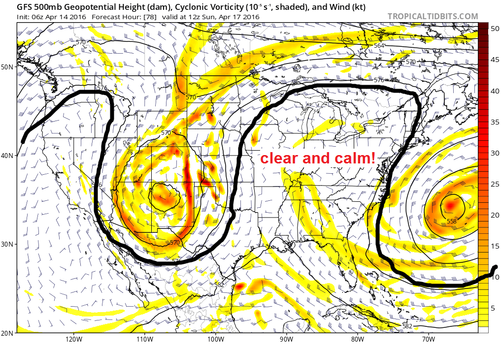
We have a blocky weather pattern in place, with the jet stream energy shunted far away from us. An upper level low will continue to meander and weaken across the South over the next couple days. This will try to bring a few clouds our way, mainly in southern Indiana, but we should stay dry. As we head into the weekend, a classic Omega Block sets up. What is that? It is called an omega block because it looks like the greek symbol omega on a map. Check out the map below. It is where there is a ridge of high pressure with low pressure on both sides of the ridge. We are going to be in the "sweet spot" with calm weather conditions - sunny and warm! This will set us up for a perfect weekend.
Here are the forecast specifics for the next several days....
TODAY: Sunny skies and pleasant temperatures. Highs 65-70°.
TONIGHT: Mostly clear and not as cold. Lows ranging from the lower to upper 40s.
FRIDAY: Mostly sunny. Warmer. Highs 70-73°.
FRIDAY NIGHT: Mostly clear. Lows in the upper 40s to near 50.
SATURDAY-SUNDAY: Sunny skies. Warm temperatures. One of the nicest spring weekends you will ever find around here. Highs in the low to middle 70s. Lows in the upper 40s.
At this time, it does not appear our next chance of rain will arrive until about next Thursday. No "major" systems are showing up anytime soon. The long range models are showing a warmer than normal pattern for the late part of the month, and you can see this on the NOAA CPC 8-14 day outlook valid from April 21-27. Here is the temperature forecast during that time....

Here is the precipitation outlook for the same time-frame.....

I appreciate you checking my latest blog update. Hope you all are able to enjoy the great weather over the next several days!