Monday, October 31, 2011

Tracking A Warm-Up, A Look At The Long-Range Outlook!

Good afternoon everyone! Thanks as always for checking in! It is turning out to be a decent day out there with a nice mix of sun & clouds! That is great news for all those trick-or-treaters this evening. Here is your full evening forecast:
   

Clear skies. 45-50.

Tuesday & Wednesday are going to be glorious, sunny days, with a perfect way to start November! Despite a frosty start tomorrow, temps will hit the middle 60s. Upper 60s likely Wednesday.

The next storm system will move in by Thursday. Thursday will be a wet day, with cooler temps in the lower 50s. Here is how the NAM plays this storm out:


Friday:


Here is a look at the rainfall totals expected right now:


Doesn't look all that impressive right now, with the heavier stuff to the west of the Hoosier state. I will keep you updated on this system over the next couple days.

Extended Outlook, What will November be like? Extreme has been the word all year long, and that should carry us into November. Here is MY thinking, take a look below:

November Thoughts:

-Several big storm systems possible over next few weeks.

-Near average temps through middle-month, still similar ups/downs.

-Major shot of arctic air looking possible around the 20-23.

-Many meteorologists are actually predicting our first snowfall around Thanksgiving!

-Similar to last year, could see a "switch" to cold for good late month as blocking sets-up like last year.

-One interesting month ahead!! Get ready for the fun ride!! :)

Thanks for checking the blog, have a great and safe evening! I will have another detailed blog update tomorrow afternoon, so don't forget to check back. God Bless!

Saturday, October 29, 2011

Historic October Blizzard slams the east coast!!

Good evening! Thanks for stopping by the blog! Sorry about my lack of posts recently. Before I get to the snowstorm raging the east coast, don't wanna forget to talk about our weather. Here are your weather highlights:

Weather Highlights:


1) Freeze likely tomorrow am.
2) Warmer Sunday - near 60
3) Rain chance Sunday evening- Monday morning
4) Dry & cool for trick-or-treaters.
5) Warm-up/sunny Tuesday-Wednesday.
6) Rain chances late next week.


 And I can't say WOW enough as to what is going on across the NE, as a rare heavy snowfall takes aim on the major cities. Over 2 million are now without power, according the TWC, as this heavy, wet snow knocks down power lines. Worse yet, the brunt of it is still to come for many! NYC alone is now expecting 4-7" of snow in downtown, with 10" west of NYC & Boston. This would be incredible for the middle of January, yet alone October!! This is something that has NEVER happened before in October! Here is some perspective as to how rare this really is:

We are definately smashing those records BIG-TIME tonight!


Jealous yet? Our fun times are coming soon, and maybe sooner than you think! :)Here are some pics:


Ebensburg, PA


Chester Springs, PA


York, PA


Here is the snowfall totals so far for the region:


I can't lie.. now I'm dying to see some snow! :D That is all for tonight, God Bless!

Wednesday, October 26, 2011

Tracking Cooler Temps - Rain Too

Good evening! Thanks for stopping by the blog. After another dry and warm one in the 70s, the changes have already began to set in. A cold front pushed through the city around 3pm, and cooler air is now moving on in. Temps will fall in the 50s this evening. Now as far as the rain, scattered showers are moving through the western half of the Hoosier state, and will be around this evening. Here is the temperature and radar map:

Indiana Temp. Map:


Indiana Temperature Map


Radar


Here is the rainfall timing for this evening....

Rainfall Timeline         

*Scattered showers become more numerous this evening.


*Steady showers overnight, esp. south of I-70.


*Rain likely through late morning Thursday, then drying out by afternoon.


*Rainfall totals will range from .25 north of city, near .50 in Indy, to 1"+ likely in southern Indiana.


Oh yeah... did I mention it will be SO much cooler tomorrow? Most of the day will be spent in the 40s. Obviously not the greatest days outside. Good news though, plenty of sunshine is in the Friday forecast, with highs in the middle 50s.

Weekend: I know a lot of people are already looking ahead to the weekend. Right now, party-mainly sunny skies expected, with the chilly air hanging on a bit. Despite some sun, temperatures will only hit the lower 50s Saturday, and middle 50s Sunday. Both mornings should deliver frost. One thing to note.. some models show weak impulses moving through the area this weekend, but it's hard to pinpoint when, and most of these will not deliver rain, so will keep things dry for now.

It looks a very slow warming trend early next week. 60s look to return again next Tuesday-Wednesday.

I will not be updating for the next few days, but you can always check out my facebook page for weather updates. I will update things again this weekend. Until then take care.. and God Bless!

Tuesday, October 25, 2011

Pics of Northern Lights last night, tracking Denver snowstorm!

Good afternoon! Thanks for checking in, on this warm fall afternoon. We have lots of changes to talk about over the coming days, including rain chances, along with a much cooler pattern that will lead into Halloween.

Before I get to that, the Norther Lights were visible for much of the U.S. last night. Unfortunately, I never had the chance to look at them! Anyway, I thought I would show you some truly amazing pics:

 Madison County, Indiana:


  Sweetser, Indiana
aurora3_20111025064222_JPG

Truly some breath-taking pictures, and truly a rare experience to Hoosiers!

Before I get to the Denver snowstorm, Here are some highlights of the weather you can expect over the next several days:

Weather Highlights:

1) System #1 will arive late tonight/early Wednesday, bringing scattered showers.
2) Dry hours tomorrow
3) Round 2 hits late tomorrow/early Thursday, with soaking rains likely.
4) Some areas could exceed 1" of rain when all said and done.
5) Drier/cool Friday-Saturday
6) Warmer by Halloween

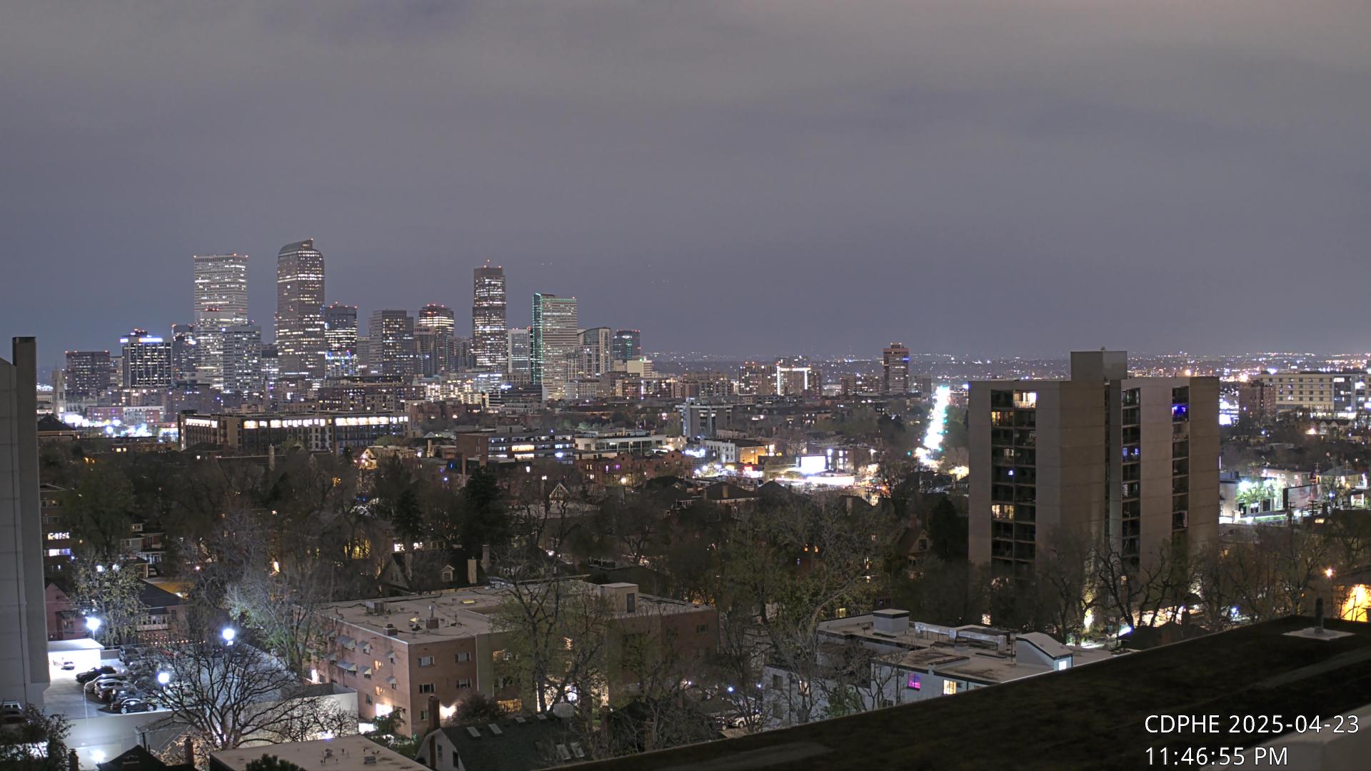
Since we have no snow to track here, I thought it would be fun to track Denver's first snowstorm with webcams and such to track it right here on the blog. After Denver hit 80* yesterday, an all-out snowstorm will hit them hard starting tonight. And we thought our weather was wild!!  A band of 4"-8" of snow expected by Wednesday afternoon for the mile-high city. Here is accuweather's snowfall map:


Their rainfall is expected to change to snow around midnight, and by morning rush, travels there will be a big mess! Now here are the webcams to track the flakes:

Downtown Denver air quality cam

I-70 & Colorado Boulevard

Denver City Government Broadway & Colfax traffic cam


Denver City Cam - location varies

Should be fun to track late tonight and all of tomorrow! Thanks for checking the blog, have a great evening!

Quick Morning Update

Good morning everyone! Thanks for checking in this morning! We are on tap for a gorgeous fall day! Highs should hit the middle 70s, with a strong southwest wind kicking in later today. Here are some hightlights to what I will be talking about in the full blog update later today:

Today's Blog Highlights:

1) System #1 of rain late tonight/early Wednesday.
2) Round #2 of heavy rain late tomorrow/early Thursday.
3) Much cooler end to the week.
4) Clipper system to watch late Friday/early Saturday.
5) Halloween Outlook.

Lots of weather to talk about today, so be sure to tune in this afternoon for that full update! Enjoy your day!

Monday, October 24, 2011

Tracking Mid-Week Changes!

Good afternoon, and thanks for stopping by the blog! We are coming off of what was another gorgeous fall weekend that featured the first heavy frost, ending the growing season. However, temps both days warmed well in the 60s, making for perfect afternoons.

After a few showers early this morning, the clouds have finally faded to mostly sunny skies. A gorgeous afternoon to check out those breath taking fall colors! Highs will hit the 63-67 degree range, with 70 possible near the Ohio River.

A fantastic evening expected if you are headed out and about! Here is your Monday evening timeline....

Monday Evening Forecast:


60s through sunset, then dropping in the lower 50s by midnight.

Tuesday will be the BEST DAY OF THE ENTIRE WEEK! Ample sunshine expected, with middle 70s. With a warm-up that dramatic, you can expect winds to become gusty from the southwest, ahead of the next storm system.

The changes begin as early as tomorrow night. Low pressure will begin to track towards the area, meaning showers, and yes, even some thunderstorms. Nothing severe expeted, but some embedded thunder and lightning possible with the heavier downpours tomorrow night.

Tuesday night:


That rain will continue off and on early Wednesday, before another shortwave moves through Wednesday
night/early Thursday. Check out this swath of heavy rain the models show:

Wednesday night:


 This will spread widespread, soaking rains into the area. The rain will begin to move out Thursday, with an improving forecast. When all is said and done by Thursday afternoon, rain totals could exceed 1" for many:

Rain Totals by Thursday Afternoon:


While much colder air will arrive late week, it doesn't appear as intense as earlier thought. It looks like several days in the lower-middle 50s, maybe even upper 40s for some Thursday, but I've seen a lot worse for late October. A "clipper-like" system may bring a couple showers to the area Saturday, but nothing of real significance. I know some of you may be asking what weather we can expect for Halloween. Right now, it's looking great! Sunshine and lower 60s expected for Halloween, with trick-or-treating temps in the 50s.

Tuesday, October 18, 2011

Afternoon Weather TALK!

Good afternoon, on this chilly and damp afternoon! Lots of weather to talk about in today's discussion, so let's get started!

This Afternoon/tonight: Rain showers continue to fall across the area. Temperatures range from 60 in southeastern Indiana, to the middle-upper 40s across north-central Indiana. As you head out this afternoon, grab the heavier coat and the umbrella! That rain will continue right through the overnight hours. Here is where you can track that rain:


Rain totals by tomorrow will be in the 1-3" range! Here is the latest HPC:


Tomorrow: More scattered showers expected. One big difference tomorrow will be very gusty winds. Wind chills may be in the upper 30s-lower 40s! Highs will struggle to get much past the upper 40s. I know tomorrow begins the Rivervale Retreat, so we want nice weather! I honestly don't expect rain every second of the day, but several radar checks will be needed if heading outdoors tomorrow.


Thursday: Same ol' story! Scattered showers, but should be a bit drier than Wednesday, especially across the southwest parts of the state. As far as the retreat, I think we should be able to get some outdoor games in with dry weather, but will have to dodge showers every now & then.Once again, winds will be very strong with all the tight pressure with this storm system. Highs on Thursday might be cooler, in the middle 40s across much of central Indiana, not factoring gusty winds.

Friday: Finally, the pattern will begin to change. A mix of sun/clouds expected, but the chill will just keep on keeping on. Highs will be in the lower 50s, with morning lows in the lower 30s. Brr!

Weekend Outloook: Looks awesome! Sunshine both days, much lighter winds, and a warming trend will commence. Highs will be near 60 Saturday, and middle 60s Sunday. :)

Next Week & Beyond: A warmer weather pattern will be the story for the beginning of next week. We may actually crack 70* by next Tuesday. The models show a pretty deep trough digging across much of the country just in time for our fall break late next week:


Accuweather was even predicting snowfall for Halloween weekend as of yesterday. I haven't checked yet today. There is great news as we head into November! A zonal flow will return, with milder temperatures returning for a while. But just how far through November? Time will tell.

Thanks for checking the blog, enjoy the rest of your day!

Wild Weather Pattern!

Good morning! Thanks for checking the blog! We are starting off the day with scattered showers, and chilly temps! We have a huge storm system moving across the area, and this will continue to effect the weather over the next several days.

Rains will become widespread today, and temps will be o' so chilly! Highs will be a struggle to get out of the 40s! Brr!


The track of this storm system looks more like a winter storm. If this were a month from now, this would likely be a massive snowstorm:


If this were December, that would be a classic set-up for a heavy snow.

Here is how the next few days should play out:

*Heavy rains will continue overnight and Wednesday.

*Winds will REALLY pick up tomorrow! Gusts over 40 mph! Wind chills in the upper 30s!!

*Rain totals by tomorrow evening could reach 2"!

*Believe me or not, SLEET may mix with some of the showers the next couple of days. Don't be surprised to hear some ice pellets hitting the windshield.

*Thursday will be another gray, blustery, cold day! Highs in the middle 40s!

*Clearing on Friday, with a warm-up setting in. Highs might actually make it out of the 40s! :)

Thanks for checking the blog, I will have another update out by middle afternoon, so set your alarms to check back! :) Have a great Tuesday. God Bless!

Monday, October 17, 2011

Tracking Major Changes!

Good afternoon! As quiet as it has been so far today, it makes it very hard to believe that MAJOR changes are on the way in less than 24 hours!

Rain showers will spread across the hoosier state by the evening. Overnight, it will become heavy at times. Here is a look at how the models spread the rain across the area:
This evening:


Overnight:


Tomorrow afternoon:


Rainfall totals by tomorrow afternoon will be decent, near 1" or so for most! Another big story tomorrow will be the CHILL! Temperatures will be around 50 all day, just a raw, damp day tomorrow.

On Wednesday-Friday, I know we are all hoping for nice weather for the retreat! Here is the full Rivervale Retreat forecast for Mitchell,IN:

Wednesday: Cloudy, scattered showers. Cold/windy. Highs upper 40s.

Thursday: Partly sunny, isolated shower/sprinkle. Cool and windy. Highs in the lower 50s. Morning lows in the upper 30s.

Friday: Mainly sunny. Warmer. Highs in the mid-upper 50s. Morning lows in the upper 20s-lower 30s.

Thanks for checking the blog, have a great evening!!

Wild Week Of Weather!

Good morning to everyone on this cool, sunny Monday morning. We've got a wild rollercoaster of weather over the next several days, along with temperatures feeling like winter. Here we go...

Today should be a decent day, with morning sun and afternoon clouds. Highs will hit the middle 60s.

Rain, heavy at times will become widespread tonight.


What a change Tuesday will bring!! Believe me or not..... highs will only hit the upper 40s tomorrow, with damp conditions outside. Check out this wild temp gradient expected tomorrow:


From 70s in southeastern KY, to upper 40s across much of Indiana. BRR!!

By Tuesday evening, rain totals will range from .75 - 1.25:


Another issue of the forecast, is a tropical system forming in the gulf:


This will not be a real impact here, but it will merge with the system just to our east. This will continue to throw low clouds and showers our way. Wednesday & Thursday. We may even see a couple of flakes in the mix by Wednesday night. Because of the shower threat, highs will struggle to get out of the 40s!! Did I mention it will be windy as well? :)

By Friday through the weekend, sunshine and a warming trend will be returning.

The pattern is loaded!! More deeper troughs will dig into the area over the next few weeks, possibly making for some early season fun and games, if you know what I mean! :)

I will have another update out by middle afternoon, so be sure to check back. Have a great day!

Sunday, October 16, 2011

Windy and Warm Day Ahead!

Good morning! A gorgeous, but windy start this morning! Temperatures are already mild, in the 50s. We should enjoy a mix of sun and clouds for most today, with more clouds and showers north of Lafayette and Kokomo. Here is today's weather timeline....

Sunday Forecast


Morning: Mostly sunny. 50s-60s.

Noon: Partly cloudy, windy!! Near 70.

Afternoon: Windy!! Sun/clouds, showers chance north of Indy. Middle-upper 70s!

Don't cancel plans today! But if you live north of Indy, you may have to dodge a couple showers this afternoon:


Have a great Sunday!

Saturday, October 15, 2011

Sunday Forecast - Next Week's Outlook

Good evening! Thanks for checking in! Turned out to be a gorgeous Saturday - a windy one at that! Winds gust up to 30 mph all afternoon! Expect more windy conditions over the next several days, along with big changes right around the corner!

Sunday: A quick, but very brief warm up is going to surge into the state! Highs will hit the middle 70s across central Indiana, with highs nearing 80 across southern Indiana. Skies will be partly sunny, and outdoor plans are a go tomorrow! :) The only exception to the warm up will be in northern Indiana, where a cold front will move in, with a small shower chance. Any showers should stay north of Indy tomorrow.


Next Week: Lots of changes on the plate for next week. Here is the GFS:


The MAIN batch of heavy rain will move through Monday night-early Tuesday. Up to 1" of rain is possible!


On Tuesday, out temps will REALLY tumble! Highs on Tuesday will only hit the middle-upper 50s with clouds and drizzle. The coldest air of the season - along with the first killing frost, will invade the Ohio Valley by mid-week:


Highs on Wednesday and Thursday will only hit the lower-middle 50s! Clouds and light drizzle will linger Wednesday, but some sun should return Thursday.

Thanks for checking the blog! Have a great rest of the weekend, and check back tomorrow for more updates. God Bless!

Friday, October 14, 2011

Friday Weather Talk - Trinity Retreat Forecast!

Good afternoon! Thanks for stopping by. Here are today's highlights:

1)Breezy/nice weekend
2)Heavy rains/sharp temp. swings Monday/Tuesday
3)Trinity retreat forecast
1) Breezy/nice weekend:

The weekend looks pretty good. Lots of sunshine tomorrow, with highs in the middle 60s. On Sunday, about a 30% chance of showers, but lots of dry weather expected. Highs Sunday will briefly warm into the 70s.

2)Heavy rains/sharp temp. swings Monday/Tuesday:

On Monday, rain showers will become likely, especially across southern Indiana. Highs will hit the lower 60s. Thunderstorms may occur Monday night down in southern Indiana, with scattered showers for the rest of Indiana. On Tuesday, MAJOR temp gradient is going to set up. We will start the day on Tuesday near 60, then quickly drop in the upper 40s. It is going to feel miserable outside, with the rain around.


3)Trinity Retreat Forecast October 19-21:
   
   Wed.                  Thurs.                Fri.
          
   High:  52.                           High: 56.                     High: 61.
   Low: 39.                            Low: 33.                     Low: 29.

Thanks for checking the blog, have a great afternoon!

Thursday, October 13, 2011

Interesting Pattern Setting Up - Cold Changes Coming!!

Good evening! Thanks for stopping by the blog! Lots of weather to talk about, and only so much time. So let's get started:

Highlights:
1) Rain chances this evening
2) Windy/nice Friday/Saturday
3) Big storm system Sunday evening/Tuesday
4) Cold blast/flurry threat

1) Rain chances this evening:


Scattered showers/thunder moved through the area today. Most areas picked up between 1/4"-1/2". Most of the rain has ended, but will keep a shower chance in the forecast until midnight.

2) Windy/nice Friday-Saturday:

Skies will clear out for our Friday, as a tight pressure gradient sets up over the area. Winds could gust over 30 mph Friday afternoon!! However, this may not be enough for NWS to issue a wind advisory. Lots of sunshine on Saturday, but remaining a bit breezy. Highs will hit the upper 60s both days. This may be the best weather weekend for the fall season.

3) Big storm system Monday/Tuesday:


A big storm system is going to take aim on the Ohio Valley early next week. Isolates showers could begin as early as Sunday night, but I'm thinking more on Monday. Heavy rains will spread into the area, and expected to continue into Tuesday. Heavy rainfall amounts possible. Too early to pinpoint exact timing and amounts.


Day 6 Fronts and Pressures
Cold/Flurry threat?:


After we get on the backside of the storm system, things get interesting!! Cold air will rush into the area, and the is the slightest threat* of a snow flurry as the precip. ends early Wednesday morning. Don't get too excited, as this is a very small threat. If this happens, it would be late Tuesday night, early Wednesday morning time frame. For Wednesday and beyond, sunshine will return, but the chill will remain! Highs will only hit the low 50s Wednesday with clouds around! Thursday and Friday will feature some sun returning with temps in the upper 50s near 60. Lows could dip below freezing at night!! Models aren't sure yet how deep the trough will be next week, so temps may be adjusted up or down in the coming days. What is certain.. this should put an end to the growing season.

The pattern we are heading into for the end of the month looks to feature below normal temps, and a fairly active pattern. A -NAO is expected to return over the next few weeks. This will create a "blocky" pattern across the country, with our weather turning colder and colder towards November. On snow, our first snowfall last year was Thanksgiving. I think this year will be earlier! This is saying something for the winter ahead! Snow is the trend! :)


Whew! A lot of typing! :) Check back in tomorrow, for another detailed forecast discussion. Have a great evening! God Bless!

Wednesday, October 12, 2011

Wednesday Afternoon Weather Talk!

Good afternoon! Thanks for stopping by the blog! We have rain on the way! So far this month, not a drop of rain has fallen, making for the driest stretch in 5 years! Here is the NAM model showing the rain tomorrow:
                      

Timing of the rain: Should arrive just after midnight, and will continue off & on through tomorrow evening. Not a total washout expected tomorrow.

Rainfall totals: Will range from as low as .25, to .75 in isolated spots.

Temperatures will be cooler over the next few days. Mainly in the 60s. Sunshine will return on Friday, with breezy conditions expected.

Weekend: Is looking wonderful! Expect abundant sunshine all weekend long, with temps in the upper 60s Sat. & lower 70s Sunday. Perfect weather for those enjoying any late season camping or just enjoying the fall colors.

Next week: Looks interesting!! A very potent fall storm will move from the midwest into the Ohio Valley late Monday. Heavy rains will move in Monday night, and continue through Tuesday night. Very high rain totals are possible, and I wouldn't rule out the severe risk! This storm will also pull down very cold air in its wake Wednesday. If your headed out to the appalacians during this time, accumulating snow will likely fall in those areas as the storm moves away. Highs Wednesday-Friday of next week will only hit the middle 50s!! Lows will dip in the upper 20s-mid 30s, marking an end to the growing season.
EURO

Thanks for checking the blog, check back for more updates! Have a great rest of the day!