Tuesday, July 3, 2012

INTENSE HEAT WAVE CONTINUES!


Good morning. Thanks for choosing my blog for your weather source! No doubt about it, we have seen incredible heat for awhile now, and it's not ending anytime soon! For most areas, we have to go all the way back to 1936 as the last time we had a heat wave this intense. Highs today through Saturday will be near 100 degrees each day. The heat indices could be as high as 105 each day. 


ANY STORM CHANCES? We do have about a 20% chance of scattered storms this afternoon. Similar to the past several days, most areas will continue to stay dry. Areas across northern Indiana could see a couple severe storms, with the chance of damaging winds and hail in the stronger storms. Looking ahead at the rest of the week, storm chances look very low. about a 10% chance tomorrow through Saturday.


4TH OF JULY: If you have plans to head out to the 4th of July fireworks in downtown Indy tomorrow, be prepared for the heat! Highs tomorrow will top out at 100°, with about a 10-20% chance of a pop-up storm through sunset. The heat will hold on for the evening. Temps will remain in the 90's through 9pm, then drop in the middle 80's by 10-11pm.


If you're looking for a cool-down, we may be looking at an end to the heat wave next week, with increased storm chances Sunday on, with temperatures possibly dropping into the upper 80's by the middle of next week, but I say that very cautiously! 


Keep staying cool. Have a great day.

Friday, June 29, 2012

SEVERE STORMS POSSIBLE THIS AFTERNOON

Good morning! The heat out there is out of control already, and the humidity is downright oppressive. The heat index is ALREADY 106 at 11 this morning! This is very dangerous, as heat illnesses can certainly happen very quickly when you add humidity to the already scorching temperatures. Highs today will once again top the century mark, with 102 expected in Indianapolis, which will once again break a record!


WW0435 SAWJUST IN- as of this blog update, a severe thunderstorm watch has been issued for most areas north of I-70. It appears a thunderstorm complex may move across northern Indiana this afternoon. This could mean damaging winds, and heavy rain in these areas, which will be a big relief from the heat and drought. Unfortunately, this complex may not reach portions of central and southern Indiana, but I will be watching the radar closely this afternoon! 


You can track the storms as they develop by clicking the "radars" tab at the top, also, you can keep an eye on the weather across all parts of Indiana by clicking the "Indiana weather cams" tab at the top of the page!


While we don't want severe storms, let's hope for some drenching rain later today! I will update my facebook weather page as needed. Have a great afternoon-stay cool!

Thursday, June 28, 2012

TODAY MAY BE THE HOTTEST IN OUR LIFETIME!


Today could be the hottest weather we will ever experience in our lifetimes. This will be the hottest weather to hit Indiana since the 1930's! Temperatures are forecasting to skyrocket in the 100's, with many areas topping out between 102-106 degrees this afternoon. The record for Indianapolis on this date is 101, and the hottest temperature ever reached in Indianapolis is 106. It's hard to believe that could be in jeopardy today!


We have an excessive heat warning in place through tomorrow evening, along with a red flag warning in effect today. This means that the combo of intense heat, dry ground, low humidity, and gusty winds will create near perfect conditions for fires to get out of control quickly. All it takes is a cigarette bud to spark a huge grass fire! You may notice that southern Indiana is not under the excessive heat warning. This does NOT mean that it will be cooler there, but they are under a different NWS office which has different criteria's that have to be met. It can be confusing, I know. Check out all the heat advisories/warnings across the midwest!


The weather pattern for tomorrow through early next week looks to remain HOT, but there will be that *chance* of some storms. In a normal summer, this pattern would be ripe for big storm complexes to move through, but with the dry ground, it may be hard to get that much moisture. This means a 20-maybe 30% chance of isolated storms each day, but this of course doesn't mean that it will rain at your house, but some areas could get some much needed downpours. #keepyourfingerscrossed


Of course, the heat will continue to be the big story, and here are some safety tips. Remember, heat is the #1 killer out of all weather extremes!


Stay cool, and have a good one!


Wednesday, June 27, 2012

Temps Near 100 - Heat Advisory -Air Quality Alert

The heat is building in this afternoon which will boost our highs to the lower 90's today.
Page2

If you think today is hot, just wait until the next several days! Highs will range from 100-105 degrees tomorrow afternoon! Highs will be near 100 Friday and Saturday..


Air quality will also be going down in the days to come..
Page


Not to mention, fire danger will be VERY high this afternoon through the next few days. Some advice, if your a smoker, don't throw your cigarette buds out the window! Also, most areas are now under burning bans. Check if your county is under one here...
Statewide Burn Ban Status for 6/27/2012 13:18:22 EDT


There may be an isolated storm or two north of I-70 Friday, then an isolated chance for everyone this weekend. However, this will bring little or no relief to the heat and drought situation. 


I see no signs of the heat letting down much over the next 7 days. The pool will be the place to be until further notice! :)


Try to stay cool!!! 

Tuesday, June 26, 2012

ALL-OUT HEAT WAVE MOVING IN!

Today was a perfect weather day! We had comfortable temperatures low humidity, and 100% sunny skies. At this point, it's hard to believe 100 degree heat is right around the corner. It will be a pleasant night to open the windows, and give the a/c a break, because it will be in full force starting tomorrow! Lows tonight will dip down in the upper 50's to near 60 degrees.


You will begin to feel the heat moving in tomorrow. Highs will reach or exceed 90 degrees for the afternoon high. You may think that is hot, but JUST WAIT until you see my predicted highs for the end of the week.......


This is a dangerous, long-lasting heat wave on the way that will challenge records, and cause more stress to the ongoing drought. The saving grace may be a cool front stalled to our north to trigger a couple storms later Friday through the weekend, but these will be isolated. 


Things are going to heat up in a hurry, so try your best to stay cool! 

Monday, June 25, 2012

GET READY FOR A DANGEROUS HEAT WAVE!

It was a very nice Monday across much of Indiana! With the passage of a cool front last night, cooler and dry air has been filtering into the region.

With the dry ground in place, a light breeze, and VERY low humidity values, this created the perfect set-up for a high fire danger out there. Over the past month, there have been so many individual fires that have been caused from cigarettes thrown from a car window, to a spark from a outdoor grill, and backyard bonfires that have been left unattended. In fact, I heard a story the other day about a backyard bonfire that was left unattended when they went to bed, and the fire actually caught their lawn on fire, then the fire spread right to the house. That is just an example of how dry it really is, and this is why backyard bonfires ARE NOT recommended until further notice. This dry weather will also mean that some towns may be cancelling 4th of July fireworks. 

Enough of that, let's get on the weather, which includes a massive heat wave on the way, that will likely carry us to the 4th of July. However, we will get to enjoy one more pleasant day. Tomorrow looks spectacular, with sunny skies and lower 80's. Temperatures tomorrow morning will be in the 50's. Now that's some perfect camping weather, just saying!


Photo: The 100 degree temps are still coming.  Look at how many areas in the Ohio Valley are going to be invaded by the triple digit temps to end the week. This looks to be a VERY DANGEROUS situation.100+ degree temps arrive in Indiana later this week!  Wednesday, the heat begins to move in. Highs will hit the lower 90's. The core of the heat will arrive Thursday and Friday. Highs will be in the range of 98-105 degrees during this time. Those numbers are INSANELY hot for anywhere in the U.S, but yet alone Indiana. That's just unheard of around here! Yes, its common to see lots of 90's, but to get near 100 degrees on at least 2-3 days in a row is just incredible for this area. On the right is a temperature map for Friday, which shows 100 degrees for Indianapolis.  
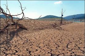

DRIEST MONTH EVER!? If you're keeping track, we are on track for the DRIEST JUNE EVER FOR INDIANAPOLIS, and not only that, but the driest month ever recorded since records began. Believe it or not, the last time Indianapolis had a good soaking rain was May 1st. That's right, ALMOST TWO MONTHS OF NO SOAKING RAINS, in Indianapolis. Other areas have seen some hit and miss rains since then, but everyone is now dealing with the extremely dry conditions. Some parts of the state are a foot behind on rainfall since January 1st. For more on this, here is a nice write up from the NWS, about the dry and hot conditions: http://www.crh.noaa.gov/news/display_cmsstory.php?wfo=ind&storyid=84481&source=0


TROPICAL STORM DEBBY: It's either feast or famine when it comes to rainfall. Tropical storm Debby is literally not moving a certain direction right now, but more or less sitting over Florida, dumping buckets of rain over the sunshine state. Some areas have already seen a foot or so of rain, and some areas could see an additional foot to foot and a half of rain. Now that is just incredible! By time Debby "downer" moves out of Florida, some areas will have had more than 2 feet of rain. Not the week to be in Florida, that's for sure. Check out the HPC rain forecast map for the next few days. It shows up to 17" of additional rain just southeast of Tallahassee!!

Ugh, only if we could get a little of that moisture, but it looks like Debby will slowly move east in the days to come, with no rainfall from the system for us. :( That's the wrap for tonight. Thanks for checking out the blog, have a good and safe rest of your evening.