Monday, February 6, 2012

Odds Of A February-March Snowstorm

With all the spring-like temps, many people seem to think we are running out of time for a real winter storm, which has yet to happen this year. However, research proves that several major snowstorms have impacted Indiana in late winter, even the one back on March 21, 2006! If you can remember, that was also a year of very little snow. So it CAN snow around here as late as early April, we just have to get the dynamics and the cold air to allow for snow. The pattern is really grabbing my attention, mainly from late next week and beyond. I wanted to show you just how many snows Indy has experienced in the February-March period over the past several years.

March 21, 2006: Heavy snowfall of 4-6" blanketed much of the state that day. Snow began to fall at 6 in the morning, creating a huge nightmare for morning travelers that day. I remember our school letting out by 11am that day, and I remember seeing the trees that were full of buds covered in the snow. That was truly an incredible event for the end of March. The picture on the right was taken in Mooresville, IN that day.


February 12-14, 2007: A major winter storm pounded Indiana, or known as the Valentine's Day storm, dumped over a foot of snow in areas. As a kid, this is my second most rememberable snow, as we were snowed in for a few days, and I had an awesome time sledding with all the neighbors! That is why I love living in the hilly country when it snows, because we can do some REAL sledding! :) Indy received between 8-9" of snow, along with some ice. Lafayette had 17" from this storm. The picture on the right was taken at the statehouse in Indy.


March 7, 2008: This was mainly a southern Indiana and Kentucky event. 2008 was also a very non-snowy winter...until March. Louisville saw up to 14" of snowfall! The picture on the right is from Carefree, IN taken during this snow event.

February 2010: February of 10' was actually a VERY snowy one around here, and featured three major winter storms just a few apart!! The first one hit on February 5th, dumping 6-10" of snow across portions of Indiana. The second one hit the 9th-10th, dumping 3-8" across the state. Believe it or not, a 3rd one hit just days later, known as the President's Day snowstorm. 6.3" was the official total in Indy, with 10-12" in portions of southeast Indiana that day. Yep, February two years ago was very snowy around here! The picture on the right was taken at the NWS office in Indy.

Did you remember having all these different snows in the February-March timeframe? Every year over the past 6 years, except 2009 and 2011 featured big-time winter storms in February or March. So it can certainly happen! All it takes is a storm system to tap into the cold air to our north, and deepen. Here is hoping we get us at least one good snowstorm before winter is said and done.

Speaking of snow.... there is potential for a dusting of snow tomorrow night into early Wednesday.

I will have another update tomorrow. Hope you enjoyed the blog post. Have a great night!

Another March-Like Afternoon - Touch Of Snow Mid-Week?

Good afternoon everyone, and happy Monday. It is the day after Super Bowl, and a day that many like to call in sick for work. If you did, I don't blame you! The weather is pretty darn awesome out there today! Yet another day of above-average temps! Today makes the 16th day in a row of above-average temps. Incredible stretch we have been in. But.. cha-cha-changes are lurking very soon in our future!

After another great day tomorrow, a weak and sneaky disturbance will move in Tuesday night-early Wednesday, bringing a streak of light snow or flurries.


That will NOT be a big deal, perhaps a dusting if your lucky. Sorry snow-lovers. :(

The bigger story will be the switch to colder temps. Highs will be stuck in the mid/upper 30's for many Wednesday, with sunshine and upper 30's-near 40 for Thursday, with sunshine returning.

By the weekend, all eyes are set to a pretty intense blast of cold air. Check out the latest EURO showing the arctic blast of air on Saturday!


This definately has the look of lows in the 12-18 degree range Saturday morning, to go along with highs mainly in the 20's to start the weekend. Definately the coldest air in quite some time! But, the seasonal trend continues! The arctic air will get attacked by milder westerly winds Sunday, with highs already warming near 40. We get well in the 40's by early next week.

Before I go, I wanted to tell you the longer range GFS is really showing a active pattern from Valentine's Day-through the end of the month. With a -NAO and a +PNA, one would think that one of these big storms would have to bring us some wintry weather, so here is hoping! Stay tuned!

Thanks for checking out the blog, have a great rest of your day.

Sunday, February 5, 2012

Super Bowl Weather Update

Good afternoon! Lots of sunshine is being reported in many areas now, and will make for a great afternoon for Super Bowl tailgating, or any outdoor activities. If you are still seeing clouds in your area, they will clear out shortly.


If your heading out to the game tonight, 6:30 kick-off temp will be near 40 degrees under clear skies. By the end of the game, it will be in the 30's.

Have a great afternoon, and GO GIANTS!

Saturday, February 4, 2012

Surprise Snow Storm Hits Northern Indiana This Morning - Looking Ahead!

Good afternoon! Well, it is nothing short of ugly out there today! Nothing is more miserable then 40 degrees and drizzle! It will remain soggy right through your Saturday afternoon!

First off, a VERY unexpected snowfall greeted folks in Fort Wayne Indiana this morning. Some areas saw 4-8" of heavy, wet snow! The pictures coming in are gorgeous!

Snow coats trees in Churubusco on February 4. 2012 at 9:24 a.m. after an unexpected snowfall overnight.

Thank goodness that temps stayed just warm enough for rain in Indy! Comes to show, that surprise snowfalls CAN happen, even with better forecasting tools. To check out the totals across northern Indiana, click the link here: http://www.crh.noaa.gov/product.php?site=iwx&product=pns&issuedby=IWX&format=CI&version=1&glossary=0

The weather system causing the clouds and rain will move on out for your Super Bowl Sunday, with sunshine by tomorrow afternoon, with highs in the upper 40's. Overall, a pretty nice day tomorrow for tailgating!

Next week will start nice and dry, but changes look to roll in by mid-week. A Polar Vortex is going to park itself over Canada, bringing several weak systems to the area. This will allow the southern storm track to suppress for a while, meaning only systems with small amounts of moisture for a while. One of those "impulses" will move in Wednesday-Thursday, and it looks to be a mainly light snow event. The GFS does show light precip in the area during this time.


If the GFS is correct, any precip from the system will fall as snow. At this point, a dusting/coating can't be ruled out, but this system will be very weak.

A few more weak systems could bring us periods of light snow next weekend, but timing isn't clear at this time. Overall, a pretty quiet weather pattern, just occasional systems to bring us light precipitation chances. It does appear to get gradually colder by the second half of the week, with highs struggling to get out of the 30's for some. The models continue to hint at very chilly air next weekend.


Beyond the 11th/12th, models are clueless what to do. Will we warm up again, or see more shots of cold air? It does appear better blocking will commence by the middle of the month, but the position of those blocks may be a bit off to get a sustained cold and snowy pattern.

Thanks for checking out the blog, have a great rest of your day!

Friday, February 3, 2012

WEATHER PATTERN TALK!

Good evening! What a week!! It has been extremely quiet in the weather department, and near record warmth! Highs each day this week were in the 50's, and 60 degrees Tuesday and Wednesday. Truly incredible weather for people that have been out at the Super Bowl Village.

I must admit - your weather dude has caught a serious case of spring fever this week. :) I am officially loving the warm weather, and honestly, I hope the pattern stays warm as we position into spring. BUT - latest model trends are looking more favorable for a real change to winter this month.

While winter has been non-existent across much of the lower 48, it has been BRUTAL in parts of the world, particularly in Europe, where over 200 are dead. Part of that is due to a sudden pattern change there. It was warm all winter, then suddenly, it got brutally cold, way below zero. Parts of northern Africa even saw rare snow flakes this week! So yeah, it's one wacky pattern across the world!

So what do I think lies ahead of us for the next several weeks? I will explain in a moment. But first, let's talk about our forecast over the short-term, which includes the rainfall chances.

Rain will arrive in Indy between 10pm-12am, and will continue off/on tomorrow. It will be a yucky and chilly day! The good news is that the rain will taper off late in the day from Indy northward.


As the precipitation comes to an end Sunday morning, a period of snow showers or a light wintry mix is possible. This is NOT expected to pose any travel concerns, perhaps some slick spots north of Indy Sunday morning.


Rain totals look to be up to 1/2" in Indy by Sunday morning, with up to 3/4" of rain possible in southern Indiana.


We will dry out Sunday afternoon, with late day sunshine expected for Super Bowl Sunday. Highs will be in the middle/upper 40's through the weekend.

Much of next week is looking very quiet and seasonal, with sunshine around, and temps mainly in the 40's. This may change by Friday of next week.

The European model is now going BONKERS with the very cold air starting a week from today, and lasting through the weekend. Check out that cold look on the model by next Friday:


That model has the makings of a TRUE change to winter, with a trough in the east, and a ridge out west, by next weekend. I know the models can certainly change ideas quick, so it will be important to "trend" the forecast as we get closer.

Another interesting solution is that all models show a storm somewhere in the eastern U.S. during the same time. I know I said the same thing a week ago for this weekend, but that snowstorm ended up hitting Denver, CO. With a negative NAO setting up, that could lead to an interesting forecast for us about a week from now.

The European model is definately an eyebrow raiser to me, and considering what happened in Europe this week, certainly can't rule out a pattern change to colder locally. One thing that worries me is that if indeed a colder pattern does commence, it may last into spring this year. Looking beyond the cold snap next weekend, it looks like an up/down pattern, with more frequent shots of cold air.

So for all the naysayers out there, a pattern change COULD be coming in about a week. I know the models may have a much warmer solution by tomorrow, but I think things are lining up for some colder weather. For now, let's take it one week at a time. Have a great evening, and thanks for checking out the blog!

Wednesday, February 1, 2012

And The Warmth Continues!

Good evening! Sorry about my lack of posts this week! I have been doing lots of studying for the ACT. Anyway, the weather this week has been nothing short of fantastic! Who would of ever thought that INDY would be seeing 50's and 60's for the week leading into Super Bowl.

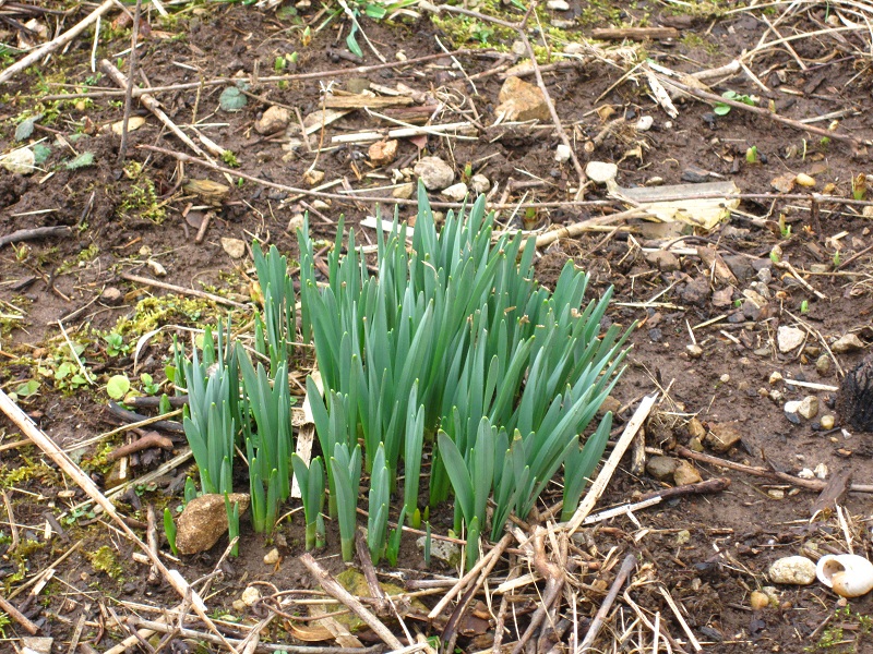
For the fun of it, the weather has been confusing the EASTER lilies! I actually saw some that were trying to bloom today Just crazy! A good 7 weeks ahead of schedule! Not only that, some of the robins have already been coming back! They are nearly 1 month early. 

Now to your forecast! Tomorrow will be a fantastic day to head out downtown, if your ready to fight huge crowds, that is! :) Highs should top out in the lower to middle 50's, under 100% sunshine! 

We squeeze in one more great day on Friday, then some changes move in for the weekend.

I don't want to show any maps, as I am running low on time. Here are some notes for Super Bowl weekend:

-Rain arrives late Friday night, continues off/on through Saturday.

-Rain will be much lighter and spotty for Super Bowl Sunday, with just isolated sprinkles being likely.

-Highs both days will be mainly in the 40's.

Temperatures will be feeling much more February-like next week, but nothing drastically cold!

Thanks for dropping by the blog, have a great night!