Thursday, May 31, 2012

LATEST ON SEVERE WEATHER TODAY

Live Camera from Unique Home Solutions, Indianapolis, IN 46241Good morning! It's a little hard to believe heavy rain and severe storms are in the forecast right now, as it is a bright and dry start to the day! BIG changes are on the way later today, and here is the latest...


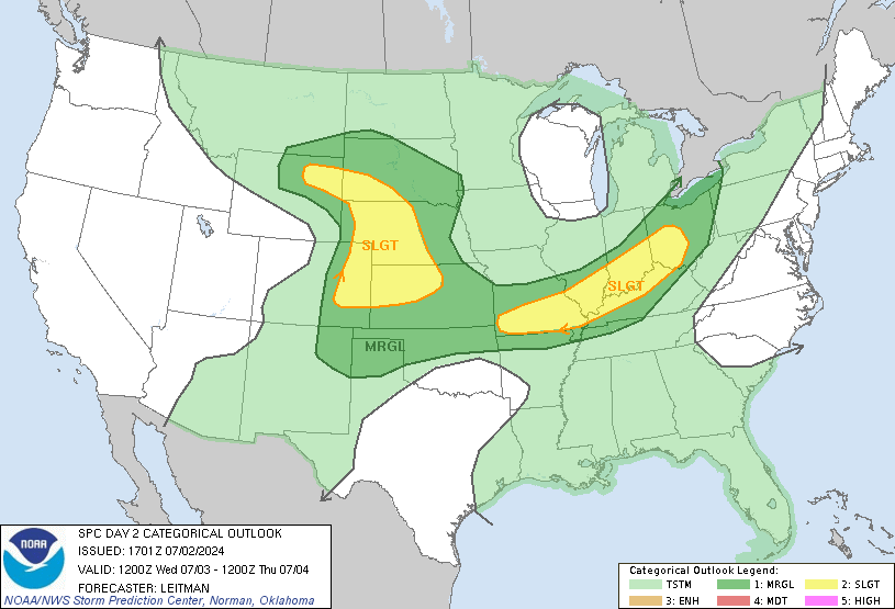
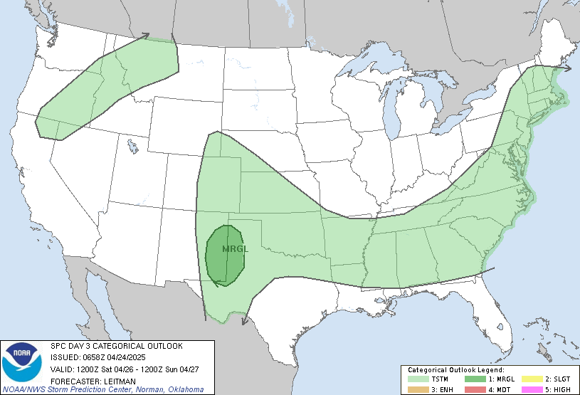
I wanted to update you with the latest chances for severe weather. Here are the latest maps from the SPC....


Notice there is a 5% tornado risk for areas south of Bloomington and Columbus this evening. The reason why is that there is going to be quite a bit of spin in the atmosphere, and changing wind directions above the surface later today, which is critical for tornadoes to develop. Obviously, damaging winds will be the highest threat across southern Indiana, with a decent threat for large hail as well.


*UPDATE* - As of this blog typing, the SPC has shifted the slight risk farther north, to include portions of southern Morgan, Johnson, and Shelby counties. This means many areas south of I-70 are now under the risk for severe storms. While I think the majority of severe weather will be south of Bloomington and Columbus, a few severe storms are possible as far north as Martinsville, Franklin, and Shelbyville. 


I will have many updates on facebook today. When warnings are issued, I will post all warnings on facebook, and I may even do live blog updates this evening if they are needed.


The timing for severe weather looks to be from 4pm to midnight. 


Stay tuned, and have a great day!

Wednesday, May 30, 2012

SEVERE WEATHER RISK TOMORROW - HEAVY RAIN AND COOLER TEMPS!

Good evening. I hope everyone got outside on this TERRIFIC weather day. Quite a change from the hot weather over the past week, as we have cooler, dry air in place. 


This will pave the way for the chilliest night in quite some time,  and yes, you may need to get the light jacket in the morning. Lows will range from the middle 40's north to the middle 50's south. Open the windows and shut off the ac!


Big changes on the way tomorrow. Clouds will quickly take over around daybreak, with widespread rainfall and strong storms south moving in during the afternoon and evening. This system will also drag a warm front up near the Ohio River. This means southern Indiana (south of Bloomington and Columbus) need to be on the lookout for severe storms tomorrow evening, as there is a slight risk for severe weather across southern Indiana, with a severe outbreak possible along and south of the Ohio River. Here are your severe storm forecast maps for tomorrow...


Track of the upper low is key for the severe weather risk. Should the low move farther north than expected, more parts of Indiana would be at risk for severe storms, which is definitely something I will monitor closely!


The severe risk for southern Indiana is concerning, because there is an elevated risk for some spin ups tomorrow, as there will be quite a bit of spin aloft. Here is a look at the wind speed just above our heads (1 mile above the surface) Thursday afternoon. Notice winds in this layer will be about 40 mph, and there will be changes in wind direction which is critical for tornadoes to develop.

NAM_850_wnd_1


Here is a look at instability values tomorrow. Notice little or no instability across central and northern Indiana, then a drastic increase in instability once you head south of Bloomington and Columbus:


I will watch this severe threat carefully, and will have many updates on facebook tomorrow. This is NOT a widespread outbreak for Indiana, but all folks in southern Indiana need to stay tuned to the local forecasts and weather radios tomorrow afternoon and evening.


The other story will be the widespread rain. .75-2" of rain is likely between now and Saturday. Notice the white shaded area across northern Indiana, this is where up to 2" of rain could fall. The rest of the area still looks to pick up to 1". Farmers all over Indiana will be very happy! 

If your making outdoor plans for the next few days, tomorrow afternoon and evening will be a washout. By Friday, the dry slot moves in, with the majority of the rain tapering away during the day. A clipper like system may bring more scattered showers Saturday. High temperatures will range from 58-78 north to south tomorrow, 60's Friday, then near 70 Saturday. That's right, below normal temps for once!!


I don't see any real hot weather returning anytime soon.


Stay tuned for severe weather updates tomorrow. Thanks for taking the time to check out my blog, have a great night.

Monday, May 28, 2012

Big Changes On The Way!

Good evening, and happy Memorial Day. I want to say a big THANK YOU to all the brave men and women who have served and fought for our freedom today. This has certainly been one of the hottest Memorial Day's on record, as we hit the lower and middle 90's again today, third day in a row of 90's. But, changes are on the way!


A cold front is working towards the state tonight, with a band of showers and storms across western Illinois...


This line should move across the state between midnight and 9am tomorrow, but this line will likely be weakening, so this won't be a big-time rain for many areas, but some areas could see up to 1/2". 


Sunshine and breezy conditions will resume for tomorrow afternoon, but it will feel a bit better! Highs will reach the middle 80's, with humidity dropping through the afternoon.


Wednesday looks GORGEOUS with sunny skies, and highs between 73-82. Humidity will be very low. Perfect yard-working conditions.


Changes will move in Thursday-Saturday, as a slow moving cut-off upper level low moves across the area, bringing widespread showers and MUCH cooler conditions. Rain looks to slowly work in later Thursday, and may stick around through early Saturday. Some thunderstorms are also possible in southern Indiana during this time, depending on the exact track of the system. Temperatures will also go WAY down during this time, only in the 60's and 70's for highs, with the coolest days likely being Friday and Saturday, when we may struggle to get out of the 60's! Yup, that's right! Here is the HPC rainfall totals for the next 5 days. This rain will be a BIG welcome, as things are drying out quickly!
HPC 1
Have a great rest of your evening!

Saturday, May 26, 2012

HOT, HOT HOT!

Our heat wave is in full swing here in the Hoosier state. Highs today ranged from 90-95. The humidity was high, but not oppressive (trying to look at the positives). :) I think the humidity will be higher tomorrow and Memorial Day, so if anything, it will feel hotter than today! Check out my predicted highs for the next couple days...


Sunday: 96 Heat index: 98-102


Monday: 92 Heat index: 95-100


Thousands of people will be headed out for the Indy 500, and wow, it will be a scorcher!! Remember to stay hydrated, slow down out there, and avoid direct sun for long periods. Remember, sunburn can increase your chances of getting heat illnesses. I am not saying that the heat should keep you from going to the track tomorrow, just make sure your prepared!!


Memorial Day will be another hot and humid day, but there is about a 30% chance of a pop-up storm. Much like yesterday, most areas won't get a drop. The better storm chances arrive Monday night and early Tuesday, as a cold front moves into the region. There will be about 50% coverage of showers and storms during this time. On the map below, you may notice the enhanced area of showers and storms across the southeast coast, that will be from Tropical storm Beryl.
For Tuesday and beyond, temps will cool down nicely each day. Low 80's Tuesday, 73-81 Wednesday, then 70's to even 60's for the end of next week, as a decent storm system slowly works across the area. This COULD bring us MUCH NEEDED rain later Thursday through Saturday. 


This forecast will be subject to change, as the track of Beryl will have an impact on this forecast. It does look likely though that much cooler air and a more active pattern could be on the horizon. 


After that, we may heat up again around June 5-12, with 80's (even some 90's) may try to return. 


Despite the ridiculous heat for now, at least we have much cooler air in the long-range forecast. :)


Friday, May 25, 2012

DANGEROUS HEAT THIS WEEKEND!

Good evening. For much of the state, it was a hot and VERY humid day! Highs ranged from the upper 80's to low 90's. Even right now, it is still in the lower 80's out! Those temps will only slooooowly drop to the low-middle 70's overnight, as the air remains very humid.


While there was a chance of storms today, most areas have seen no rain, with much of the activity being along the front in north-central Indiana. This is where we have a clash of air masses. Northern Indiana is experiencing a dry and comfortable air mass, while central and southern Indiana is feeling the tropical air mass, with all the humidity. Here is a look at radar, you can see the storms forming north of Indianapolis, along the front.
That front will begin to work northward tonight as a warm front, with the heat and humidity taking center stage all weekend long!


Here is the weekend forecast! Does the word hot even say enough for this forecast? Whew!

Make sure you are prepared for the heat. Remember, it's still early in the season, so we aren't accustomed to heat of this magnitude. Here is a great link for heat safety tips: http://www.nws.noaa.gov/os/heat/index.shtml

Here are some interesting facts. If my predicted high for Sunday is correct, it will not only make the hottest Indy 500 ever, but will tie for the highest temperature ever reached in May in Indianapolis. That record was set 101 years ago! 


The NWS has made the right call by issuing a heat advisory from noon tomorrow through 8pm Sunday. Here is their statement.....

* TEMPERATURE: HEAT INDEX VALUES IN THE MIDDLE 90S FOR
  SATURDAY...AND EVEN WARMER HEAT INDICES IN THE UPPER 90S TO
  AROUND 100 DEGREES FOR SUNDAY. OVERNIGHT HEAT INDICES WILL
  ALSO BE QUITE WARM IN THE MID TO UPPER 70S.

* IMPACTS: THOSE PLANNING TO SPEND TIME OUTDOORS THIS WEEKEND
  SHOULD TAKE EXTRA CARE TO AVOID SUNBURN AND DEHYDRATION.

PRECAUTIONARY/PREPAREDNESS ACTIONS...

TAKE EXTRA PRECAUTIONS IF YOU WORK OR SPEND TIME OUTSIDE. WHEN
POSSIBLE...RESCHEDULE STRENUOUS ACTIVITIES TO EARLY MORNING OR
EVENING. KNOW THE SIGNS OF HEAT EXHAUSTION AND HEAT STROKE. WEAR
LIGHT WEIGHT AND LOOSE FITTING CLOTHING WHEN POSSIBLE AND DRINK
PLENTY OF WATER.

TO REDUCE RISK DURING OUTDOOR WORK...THE OCCUPATIONAL SAFETY AND
HEALTH ADMINISTRATION RECOMMENDS SCHEDULING FREQUENT REST BREAKS
IN SHADED OR AIR CONDITIONED ENVIRONMENTS. ANYONE OVERCOME BY
HEAT SHOULD BE MOVED TO A COOL AND SHADED LOCATION. HEAT STROKE
IS AN EMERGENCY...CALL 9 1 1.

Finally, here is the 7-day forecast. Despite the oppressive heat this weekend, a big cool-down is on the way for the second half of next week. Some models hint at highs in the 60's next Friday, believe it or not!!

Have an awesome and blessed Holiday weekend. Stay cool, if possible. :) 

Thursday, May 24, 2012

TRACKING HOT TEMPS - WATCHING THE TROPICS!

Good afternoon. Sorry about my lack of blog/facebook weather updates! The blog will become alive again since my summer break starts tomorrow. :)


Anyway, the heat has arrived. Current temps are running in the middle to upper 80's, with sunshine and windy conditions. From here on out, it's only going to get hotter, and if the forecast is correct, this will be the hottest Indy 500 EVER. Now that's just incredible.


The main feature in the short-term is a cold front that will try to move towards the area tomorrow. This will help create more cloud-cover, with a few thunderstorms during the afternoon. As has been the case, only a few areas will actually get wet, more areas won't see a drop. It will be a hot and muggy day if your headed out for Carb Day at the track, highs will hit the upper 80's. 


That same front lifts north of the area Friday night and Saturday, as the heat wave arrives! Here is your Memorial/Race weekend forecast....


Remember to stay hydrated and slow it down out there! Remember to never leave small children in a car, even if it's just for a few minutes. Best advice is to go swimming! I'm sure many people will be hitting the lakes this weekend!


A front will move in the area around Tuesday, bringing storm chances and MUCH cooler temps to the area. We may be in the upper 70's by next Wednesday! 


Tropics Update: We already had the first tropical storm of the season last weekend (Alberto) and now I am watching a system just off the southeast U.S. coast. This circled area could become Beryl in the next 48 hours:


Hhberybl


This to me definitely looks to form into a tropical storm, perhaps a stronger one, for the weekend. 


The NAM model actually takes this storm directly to Savannah, GA later Sunday. This is definitely interesting because Savannah hasn't had a direct landfall in more than 100 years.


If you have travel plans down there this weekend, definitely keep an eye on the local forecasts. 


Despite all this pre-season activity, the National Hurricane Center predicts a near-normal season, with 9-15 named storms, 4-8 hurricanes, and 1-3 major hurricanes. Will be interesting to see how it all plays out.


Thanks for stopping by the blog, have a great evening!

Tuesday, May 22, 2012

MAJOR HEAT WAVE ON THE WAY!

Open the windows tonight, as we have another night with wonderful temperatures, falling in the upper 40's to middle 50's. Enjoy it, because the hottest air since last September is about to move into the area! 


Major Heat Later This Week: A large, summer-time ridge will build in later this week through Memorial Day, bringing the hottest temperatures since September 2011. Temperatures will go from the lower 80's tomorrow, upper 80's Thursday, then 90-96 for Friday-Memorial Day. Here is your full Memorial weekend forecast...


With very high humidity levels, the "feels-like" temperature will be 100-105 degrees during the heat of the day! Temperatures out on the track for the Indy 500 could easily reach or exceed 120 degrees on the pavement! Also, this is forecast to be the hottest Indy 500 ever!


Here is the dewpoint chart. When the dewpoint temperature climbs above 60-65, it gets uncomfortable. Once the dewpoint is at 70 or above, it feels miserable outside. A dewpoint of 70 degrees and an air temperature of 93 would easily translate to a "feel-like" temperature of 100 degrees.


Just because were talking about hot weather doesn't mean you should stay away from the events this weekend. Just prepare yourself for the heat ahead of time and you should be in good shape. If you need some advice, here is a great link to check out for heat safety: http://www.nws.noaa.gov/os/heat/index.shtml


So bottom line, be prepared for a hot weekend, with dangerous humidity values. It's time to get the pools ready! :)


Thanks for stopping by, have a great night. 


Sunday, May 20, 2012

HEAT RELIEF ON THE WAY - BUT IT'S BRIEF!

It was definitely the hottest weekend of the season today. Check out some area high temps today! Some areas topped 90 degrees...

Terre Haute: 92
Lafayette: 90
Indianapolis: 88
Vincennes: 92

Definitely feeling like summer as of late! The good news is that a very nice cool-down is on the way. In fact, 70's for highs are expected for a couple days, with pleasantly cooler nights. Enjoy it, because things will heat up in a BIG way by late week and through the holiday weekend. More on that in a second. 

TONIGHT/TOMORROW: A cold front is headed our way this evening, with shower and thunderstorm activity moving towards the state line. Here is a regional look at sat/radar:


Shower and storms will move slowly into the area tonight, but severe weather is not likely. Nevertheless, lightning and heavy rain are threats with any storms. These storms will be on a scattered basis, so not everybody will get wet. The cold front moves through the state early tomorrow, with showers/storms working southeast of the area by the afternoon. This means MUCH cooler temps tomorrow. Northwest Indiana will only hit the 60's, with low-middle 70's for most. If the front slows across southeastern Indiana, those places could briefly touch 80. 

LOOKING AHEAD: Absolutely gorgeous weather sets in for Tuesday. Expect plenty of sunshine, with highs in the lower to middle 70's, with low humidity. Good day to do any strenuous activities outdoors! 

For Wednesday and beyond, dry weather will prevail, with temperatures rebounding quickly each day. It will be nearing 80 Wednesday, but hot temps and humidity make a comeback Thursday-Sunday. Highs in the middle/upper 80's Thursday, then 90-93 Friday-Sunday!! Get those pools ready, you will need them for Memorial weekend! 

Overall, the next 8-14 days will be warm to hot around here, with much above normal temps for the end of May...

6 to 10 Day Outlook - Temperature Probability

Also, this May is already looking to go down as a very warm and dry one. Indianapolis is already close to 1.25" below normal rainfall for the month to date, and the rest of the month certainly doesn't look to change in terms of rainfall. I am not liking all this heat and dryness for so early in the season, I am getting worried of a very hot and dry summer! Let's hope I'm wrong. The past year has seen above normal temps every month, and the past winter and this spring so far is going down as the warmest (or next to warmest) on record. In Louisville, 2012 has been the warmest year EVER so far. I really don't see why the "above normal trend" would end anytime soon. 


SOLAR ECLIPSE UPDATE: An annular solar eclipse took shape a while ago. While viewing was not good in Indiana, portions of New Mexico, Arizona had good viewing. The eclipse also took shape in other parts of the world, including Tokyo, Japan. Check out this shot  of the solar eclipse over Tokyo. Is this amazing or what?! 


Thanks for stopping by for your latest weather forecast, have a great rest of the evening. 

Thursday, May 17, 2012

Tracking Heat For The Weekend - Early Memorial Day Outlook

We did it again.. it was another absolutely beautiful day out! We had very low humidity, and highs in the middle 70's. It seems like an unbroken stretch of great weather, and that trend will continue. :) 


First off, tomorrow will be another picture-perfect day to head out to the track, as it will be warmer than today, but certainly not too hot. Here is the forecast...


Hot, humid, but dry for the weekend, with temperatures hitting the middle to upper 80's for highs, under mostly sunny skies. 


A front will move in the area Monday/Tuesday, bringing the chance of showers and storms.


Then we prepare for Memorial Day Weekend. It appears that the heat will surge in late next week and through the holiday weekend. Some areas could see the first 90 of the year in this set-up:


We'll wait and see. Certainly looking more and more like an early summer pattern. Thanks for reading! Until next time, take care.

FANTASTIC WEATHER CONTINUES - ONLY GETTING HOTTER FROM HERE!

Good morning! I'm sure you thought the blog has died, due to my lack of updates! I was down with a severe cold during the weekend and earlier this week, but I'm much better now, which means the blog will be updated as usual. :)


What a gorgeous week it has been! Temperatures have been nothing short of pleasant running in the 70's and 80's for highs, and low temps have actually been cool, in the 40's an 50's. This big temperature difference is due to the very dry air in place. 


A cold front moved through the Ohio Valley yesterday, just ushering in even drier and pleasant weather. The very low humidity and sunshine will be the rule again today. After morning lows in the upper 40's to low 50's, temperatures today will soar into the middle and upper 70's. It will be fantastic weather to head out to the track today.......


As head into tomorrow and through the weekend, the temperatures and the humidity will be on the increase each day. Highs will be in the lower 80's tomorrow, then into the middle to upper 80's this weekend, with a heat index near 90. It's going to be a hot weekend, and perfect weather to open up the pool! 


Just a few notes for next week...


-There appears to be a pretty good chance of shower and thunderstorm activity next Monday and Tuesday, as a front moves into the region. We REALLY need the rain, but I don't think this will be a soaking rain for everyone at this point.


-We should dry out by next Wednesday and beyond, as the hottest air of the season moves in. If the models are correct, many areas could see the first 90 degree day or (days) later next week! 


By the way... we are getting into a very warm pattern. The "coolest" high temp over the next 10 days is in the upper 70's. So rule of thumb... get used to the heat! It's still a month until the 'official' start to summer. 


Thanks for stopping by, have a great Thursday... and get outside!


Saturday, May 12, 2012

Mother's Day Forecast - Rain or Not?

Not a bad day today. Other than a few sprinkles across far northern & southern Indiana, most areas stayed dry all day long, with those pleasant temperatures in the 70's. Now we are looking ahead to Mother's Day! Will it be wet?

There are actually two systems in the area. A cold front to our north, and a huge cut-off low to our south.


With these systems in the area, this will mean at least a chance of showers overnight, but the best chances will be across far southeast Indiana.

For Mother's Day, the best chances of rain by far will be across extreme southeastern Indiana, with "just a chance" of showers elsewhere. If anything, the best chance of showers will be early in the day, with many dry hours during the afternoon, especially across central & northern Indiana. Here is a breakdown of rain chances across the state tomorrow..

Check out this rainfall map! Much of Kentucky will see 1-4" of rain, will areas north of the Ohio River get next to nothing. Things have been running a little dry this spring, and I don't see that changing anytime soon.

After tomorrow, will will enter a sunny, warm, and dry period for the coming up work-week. Thanks for stopping by, have a great rest of your weekend, and have a great Mother's Day!

Friday, May 11, 2012

Fantastic Afternoon - Weekend Outlook

Come see Seussical tonight!! Good afternoon. Hope everyone is having a great Friday! Before I get to the weather, don't forget to come to Trinity Christian School for your final chance to see the Seussical performance. Tickets are $7.50. If you don't come, you are REALLY missing out! If you need directions, the address is 440 St. Peter Street, Indianapolis, IN 46201. 

Weather outlook this afternoon through the weekend: Absolutely fantastic weather out there today. Seriously, what beats sunshine, LOW humidity, and middle 70's? I don't think it could get an ounce better outside. Obviously any outdoor plans this evening are in great shape, and temps will not cool off as much tonight, with warmer air an clouds streaming in. Much of Saturday looks great, with just an increase in cloud cover. Highs will pleasant again, in the range of 73-80 across the state. After noon tomorrow, a cold front will be moving closer to the area, which may provide a few showers across northern Indiana later in the day/evening:
1front

For Mother's Day, there will be a cut-off low pressure to the south, with a cold front in the area. I will keep a chance of scattered showers or storms anytime, anywhere, but certainly not a washout of a day. 

Next week: The week will begin with a cut-off low to our south, which will dump HEAVY rain across much of the southern states. (NOT HERE)! :) Check out the 5-day rainfall forecast from HPC:

Our forecast is actually looking very nice for much of next week. It appears rain will depart the area later Monday, with dry weather to follow for Tuesday through next Friday, with temperatures in the 70s to even 80s by the end of the week. Can you believe it, I will start getting the pool ready for summer next week. Where did the school year go? 

Thanks for choosing my weather blog for your forecast! Have a great afternoon!

Tuesday, May 8, 2012

Pleasant Temperatures Ahead - Outlook Through the End of May!

It was a very nice day across the state, and the cooler and less humid air was definitely a huge relief today! After mid 80's yesterday, (with heat indices as high as 90) highs today only hit the lower 70's! The real heat looks to stay away for awhile, with temperatures actually staying around average for the next several days.


Tomorrow looks to be even cooler than today. Temperatures will start off cool in the lower 50's, only warming into the mid/upper 60's, with more clouds than sun, along with a good breeze. A few sprinkles are possible tomorrow afternoon, but shouldn't be enough to impact any outdoor plans. You may even want a light jacket at times tomorrow. :)


Thursday through Saturday look absolutely gorgeous to say the least. Plenty of sunshine will be the rule, with chilly mornings in the 40's and 50's, with highs mainly in the range of near 70 Thursday, then well in the 70's Friday and Saturday. 


A cold front looks to move into the area for Mother's Day, then stall out into next week. This will result in another stormy pattern for a bit, with temperatures slightly below normal during this time-frame. I will fine-tune the Mother's Day forecast as we get closer.


Nate's Weather Outlook (Next 1-3 Weeks)....


Thanks for stopping by the blog for your weather source. Have a great night!

A NORMAL AND QUIET PATTERN ON THE WAY - YES!!

I will cover this evening's showers/storms on my facebook page. I wanted to update the blog with a look ahead. Here we go..

Outlook: A relatively quiet and normal temperature pattern looks to stay around for the rest of the week, in fact, looking out to May 21st, I see a near normal temperature pattern, with near normal precipitation. With all the CRAZY weather over the past several months, it will be nice to actually have some "normal" weather around here. :) 

For tomorrow, the front will continue to push farther away, with a dry and mild day expected. The humidity will be lower, and temperatures will be a good 10 degrees cooler than today. Indy hit 85 today, tomorrow should top out in the middle 70's, with a mix of sun and clouds. A nice, typical May day!

For Wednesday, the cooler air really begins to settle in! Highs will be mainly in the upper 60's! With the upper trough moving in, I can't rule out a shower or two. Here is the GFS later Wednesday...


Thursday through Saturday look SPECTACULAR! How does low humidity, sunny skies, warm days and cool nights sound? Perfect  weather in my opinion.

Check out the 7-day forecast. A good looking week!


Monday, May 7, 2012

STORMS POPPING UP!

Good afternoon! It's another hot, muggy afternoon, with several storms popping up with daytime heating. No warnings at this time, but a gusty storm with heavy rain and vivid lightning is near Muncie, with several new cells popping up west and south of Indianapolis. An increase in thunderstorm activity can be expected as the afternoon/evening progresses. Keep a close eye on radar before you head out....


The good news is that the area is not under a severe weather risk, but I can't rule out a warning or two. If there are any severe storms to talk about, I will be sure to update my facebook page..... http://www.facebook.com/Nathanlovesweather4

I will have another update later this evening, with the forecast for the next several days. Keep an eye on the sky, and have a great evening!


Sunday, May 6, 2012

Tracking Storms - Week Ahead Outlook

Most areas saw plenty of sunshine both days this weekend, along with downright July-like temperatures. We have increasing storm chances in the short-term, and if your ready for some cooler, pleasant weather, we have just that arriving by mid-week! Let's get down to the forecast...


EVENING:
A swath of severe storms has entered areas northwest of Indianapolis from areas west of Crawfordsville up towards Lafayette. A SEVERE THUNDERSTORM WARNING has been issued for Parke, Fountain, and Montgomery counties until 9pm. Expect high winds ahead of these storms. This storms should clip the Indianapolis area in the next 1-2 hours, but will be weakening. Stay tuned to the radar before you head out. The other story is the HEAT! Just shy of 9pm, the heat index in Terre Haute is 88!! It is a very, very humid evening. 


OVERNIGHT: I will continue to keep a chance of showers/storms, but don't expect much if any severe weather. Not everyone will get stormed on tonight, but areas that do could see heavy rain and plenty of lightning.


MONDAY:
A cold front moves through the area later in the afternoon and evening. Ahead of the front, plenty of unstable air, so I will keep a good chance of showers and storms through the day, with the highest chances during the afternoon hours. There is also a slight risk of severe storms tomorrow...


This is NOT expected to be a major severe weather outbreak by any means, nor will tomorrow be a "total" washout, but a few storms out there could produce large hail, damaging winds, and can't ever rule out that threat of a spin-up or two. Will keep a close eye. Temperatures will remain warm, in the 70's north, to low 80's south of I-70.


LOOKING AHEAD....
The front should push far enough south for dry weather by Tuesday. Temperatures will be cooler, but still mainly in the 70's. A trough really digs into the Ohio Valley on Wednesday, and may provide a shower or two, but most areas will remain dry. High temperatures Wednesday and Thursday look to be mainly in the 60's, with low temps dipping back in the 40's for a couple nights. By Friday and the weekend, temperatures will gradually warm back into the lower to middle 70's. The next chance of rain may arrive by Mother's Day. The overall pattern for the next couple weeks looks to feature near to slightly below normal temps in the Ohio Valley, with the heat taking shape just to our west for a while....


Until next time... take care!

Friday, May 4, 2012

Evening Storms - Weekend Forecast

Good evening! Plenty of events taking place this weekend. The mini marathon in downtown Indy begins at 7:30 in the morning, plus, the big Kentucky Derby is taking shape tomorrow at Churchill Downs in Louisville. How's the forecast looking? Take a look..

THIS EVENING:
Scattered storms have developed across western portions of the state. There is a risk for a few severe storms, with large hail, damaging winds, and heavy rain being threats. Check radar before you head out by checking out the radars tab at the top.

TOMORROW:
Heat and humidity will be a big problem for runners in the morning. During the race, temps will quickly warm well into the 70's, and humidity will make it feel warmer. Remember to drink tons of fluids! A spotty storm is possible, but the race certainly doesn't look to be a washout by any means!

If your headed southbound for the Kentucky Derby, it will be hot and humid, with a storm or two. You will need both the sunscreen and the umbrella.

Sunday looks to be the drier of the two days, with most areas enjoying sunshine and no storm activity. If there are any storms Sunday, they will be off to the west, moving in AFTER sunset. Temperatures to end the weekend will stay quite warm out there, mainly in the 78-88 degree range! 

Not a bad looking weekend! A nice cool-down is still in the works for next week, in fact, a few days in the 60's are possible. More on that later.

Don't forget to check out the radars tab before you head out, because if you do get under a storm, you may have to deal with torrential rains that will make driving tough. Have a great evening, and thanks for choosing Nate's Weather Blog for your dependable forecast!

Wednesday, May 2, 2012

More Record Heat - Storm Chances

Talk about a HOT day! Whew! Areas that saw plenty of sun today topped out in the upper 80's to near 90. Areas that had some more clouds and storms saw temps in the range of 80-85. More record heat (and storms) on the way. Here is your forecast.....

TONIGHT:
Humidity is sky high, so don't expect temperatures to cool much overnight, despite a clear sky. Lows will generally drop to the mid 60's by daybreak. Sounds like perfect camping weather, doesn't it?! 

TOMORROW:
 Another hot, humid day. Most areas should see plenty of sunshine, which should easily boost highs in the upper 80's to near 90 degrees. Several locations could tie or break record highs. How about storm chances? I will keep about a 10% chance of a pop up storm, but the atmosphere should stay 'capped' for much of the day, due to a high pressure ridge in the area.

LOOKING AHEAD:
Storm chances go up again beginning Friday, and lasting through early next week, as a front stalls out across the area. The SPC has already placed a slight risk for severe weather from Indianapolis and points northward for Friday....

Despite storm chances this weekend, it will by no means be a washout. Each day should feature the highest threat of storms during the afternoon hours. Temperatures will remain warm and muggy. Any storms during this time frame could contain flash flooding, dangerous lightning, and large hail. 

The active pattern looks to hang on next week, as temperatures begin to trend back to normal. 

Thanks for choosing my weather blog for your forecast, have a great rest of your evening.

Tuesday, May 1, 2012

STORM UPDATE - HEATING UP NEXT COUPLE DAYS!

Storm Update: No warnings right now, but it's amazing how storms just keep on developing from Martinsville eastward to Connersville. This spells trouble, as these storms are dumping massive rainfall amounts in very little time. If you are out traveling tonight, watch out for extensive ponding on the road. Remember, it doesn't take but a couple inches of water to throw a car off a highway. Here is the latest radar image...


Storm Reports: There were actually many tornado reports along a supercell that moved from Champaign, IL to Crawfordsville. Storm spotters reported funnels, not sure if there was actually a tornado on the ground at some point. In the Indianapolis area, and much of central Indiana, hail was a common report, with just a few wind reports...


Today's severe weather reports

Get ready for some HOT weather: Big-time heat and humidity still look likely tomorrow and Thursday, as our storm chances go down. Temperatures look nothing short of hot, with highs soaring into the upper 80's both days. As far as storm chances, I will keep a 30% chance of a storm across the area tomorrow, but they will be MUCH more spotty in nature than the last couple days. On Thursday, the ridge should be strong enough to ensure a dry forecast for everyone.


If you have outdoor activities the next couple of days, you will need the sunscreen, shorts, and the bottle of water! :)


Have a great night..more updates tomorrow!

Thunderstorms Moving In!

Good afternoon. I am very short on time, but wanted to drop by with an update. Here in Indianapolis, skies are turning dark, and you can hear thunder as well. A line of gusty winds, lightning, and very heavy rain is getting ready to move through.  This is all moving along a warm front. Here is a look at radar..

However, I think there is better news for the evening. Once this line gets out of here early this afternoon, there may be a lull in the action. While a few more storms are certainly expected to pop this evening, this will be widely scattered, unlike the widespread storms yesterday evening. Any storms that do pop have the potential to become severe, with large hail and damaging winds being the main threats. When thunder roars...get indoors! :)


Storms Again Today - Then Near 90 Possible!

Foggy morning as your headed out this morning. The National Weather Service has issued a dense fog advisory for portions of the area until 10am. 

After the fog burns off, it will warm up to the middle and upper 70's, but storms are looking likely (again) late this afternoon and this evening. Watch out anytime after noon today, as any storms could contain very, very heavy downpours, lots of lightning, and maybe a couple containing large hail and damaging wind. Despite that, widespread severe weather is not likely. Here is the radar to track today's storms...

After today, the big story turns to a summer-like heat wave! I call 85-90 a heat wave for early May! While a very isolated storm can't be ruled out Wednesday-Friday, many areas won't see any rain. Thursday should see the peak of the heat, when a few 90 degree readings can be reached anywhere in the state. This will also mean several records will be tied or broken. Just check out the temperature map! Very, very warm from the Rockies to Maine...

Storm chances gradually go up this weekend, but it looks to stay quite warm and humid. 

Have an awesome day, everyone!