Weekend Storm Chance? Plenty of 90's On The Way!
Weekend Storm Chances? South winds this weekend will usher in much more tropical, humid air from the south, meaning a better chance of getting a few afternoon storms the next couple days, but don't worry, most places will stay dry. I know we are praying for rain as this has been the driest June ever so far for much of Indiana. Most yards look like burnt toast, right? :) However, where it does rain, it could pour! With slow moving storms, someone a few miles from you could get a drenching downpour, while your neighborhood doesn't get a drop. That's a typical summer-time pattern. I will say though, the latest GFS has more widespread storm development Sunday, but keep in mind the models have "overdone" precip as of late. Here is the GFS model for Sunday afternoon, showing a good deal of storms across Indiana:

Bottom Line: Don't cancel any outdoor plans this weekend. Tomorrow's storm chance doesn't look great, 10-20% coverage during peak heating. With a front trying to come down Sunday, this should enhance afternoon storms, but the day will by no means be a washout either. Storm coverage will be about 40%, mainly during the afternoon heat.
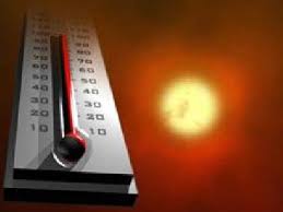 HEAT WAVE NEXT WEEK? The same front will lift north as a warm front Monday, bringing in hot, hazy and humid weather for much of next week. Unfortunately, this appears to be another stretch of dry weather, too. Interestingly, areas in northern Indiana may get hotter than southern Indiana, as that is where the core of the heat will set up. Anyway, widespread high temperatures in the range of 92-97 appear likely. Perfect pool weather! Storm chances look to return by next Friday, with a big temperature drop possible by the following weekend.
I am off to Florida for the next week, so my blog posts will be limited. However, I will update my facebook weather page often. You can "like" it by going to the "facebook page" tab at the top.
Hope everyone has a great Father's Day weekend!


No comments:
Post a Comment