 Good evening! Talk about a mild day! 58 was the high temperature in Indy today! I know a lot of people are loving it. Not only does it feel like spring...it even looks like spring in some places! When I came home today, I found three crocus plants blooming in my yard....
On to the weather.. we have scattered showers moving across the state. Nothing too heavy, just enough to make the roads damp. On a side note, the winds will continue to be very gusty overnight. It would be a good idea to secure any loose outdoor furniture.
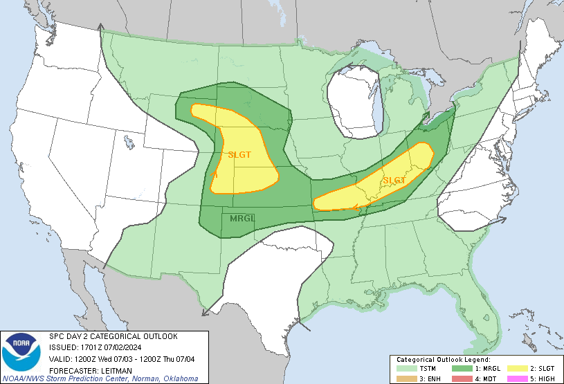
Tomorrow, the best chance of showers will be along and north of I-70. It will be another mild day, with a bit of a temperature spread setting up. Areas near Louisville in southern Indiana will get close to 70 degrees, with 60's as far north as Bloomington and Columbus. Indy should reach the mid/upper 50's, with cooler air lingering in northern Indiana. Due to some warmer air and instability to our south, the SPC has placed extreme southern Indiana in a slight risk for severe storms...

If anything turns severe down there, I will let you know via facebook or twitter tomorrow. The best chance for any severe weather in that area would be between 4-8pm. There aren't a ton of dynamics coming together for this, so I'm not too impressed with the severe potential.
By Friday, MUCH colder air moves in! It looks like we could see some lingering snow flurries/sprinkles during the day Friday. With enough cold air filtering in Friday evening, snow flurries may be flying around.
No accumulations in central or southern Indiana, but the area of concern would be extreme northern Indiana. Here is my snowfall map for extreme northern Indiana and southern Michigan:
Keep that in mind if your plans take you north late Friday through Saturday.
The weekend looks to start very chilly, with many areas staying in the 30's for highs Saturday! Much warmer by Sunday, in the upper 40's. Both days will be dry.
The active pattern continues into next week. Temperatures will get close to 50 on Monday, with another rain chance. Back to the upper 30's Tuesday, then another storm system moves in Wednesday. Interestingly, some models say heavy snow, others say rain. Bottom line.. more headaches on the way. I might as well hide from the models, to avoid all the usual weather model drama. :)
The models continue to show a up and down pattern over the next few weeks. Lots of ups and downs to deal with. If your familiar with weather in the Ohio Valley, this is a very common pattern around here this time of year. It is important to not get used to any type of weather around here, because mother nature sure likes to confuse us this time of year!
Don't forget you can check the latest radar at the "radars" tab at the top of the page. Thanks for checking the blog, have a great evening!


No comments:
Post a Comment