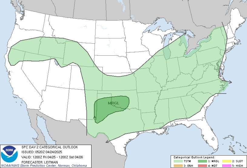
Rain showers move in after midnight, along a warm front. This should hold off until after prom. By Friday morning, .50-1" is likely. Heavy rain, along with some storms, will continue for the better part of tomorrow. Some of those could be severe. Here is the SPC map:

I will update tomorrow if anything turns severe. Heavy rain is a MAJOR threat! 2-3" of rain is likely by Saturday morning, with isolated 4" amounts is southern Indiana. I expect several roads to be closed due to flooding this weekend.
Easter Weekend: It looks to be a wet Easter weekend! While it won't rain all the time, there is a good threat of rain both days, due to a boundary across Indiana. Impulses will move along it, keeping it unsettled around here! If this helps, it will be warm! Highs will be near 70 both days.
Next Week: More of the same! Monday and Tuesday will be wet, along with some severe storms. We will warm up, too! Highs will be in the mid 70s. Lows Monday and Tuesday night may stay in the 50s & 60s. Here are some maps:

After Wednesday morning, we should dry out with sunshine for the second half of next week, with highs near 70.
Before I go, there were 14 confirmed tornados in Indiana Tuesday. Here are the counties:
- EF2 tornado just south of Lafayette near Tippecanoe County roads 100 East and 500 South
- EF2 tornado just north of Bretzville, on the ground for more than 3 miles.
- Two EF1 tornadoes in Dubois County, one near St. Anthony, on the ground for about half a mile, and another north of Ireland, on the ground for about 3 miles.
- EF1 intensity tornado on the ground for about half a mile in Boone County, immediately west of Thorntown
- EF1 tornado in Jay County, skipped along a path of almost seven miles in an area southwest of Jay City. At least two structures suffered heavy damage.
- Two EF1 tornadoes in Grant County, one on the ground for 2.5 miles in an area southwest of Fairmount, and the other on the ground for 2.5 miles through Upland. Several structures in each location suffered heavy damage.
- EF1 in Clark County, on the ground for 1.2 miles in an area north of Jeffersonville, including a path through a trailer park, where 20 to 25 trailers were damaged. A portion of a church was destroyed.
- EF0 tornado, in Clark County in southern Indiana.
- EF0 tornado in Harrison County, on the ground for about a third of a mile in an area northeast of Corydon.
- Two EF0 tornadoes in Cass County, about 5 miles apart, near Twelve Mile, both on the ground for about 50 yards.
- EF0 tornado in Dubois County, 3 miles north of Huntingburg, on the ground for about a third of a mile.
Have a great day!

No comments:
Post a Comment